Cordillera GeoServices
Company Overview
Cordillera Geo-Services (CGS) is certified as a Texas Historically Underutilized Business (HUB), a Minority-Owned Business Enterprise (MBE), and a Disadvantaged Business Enterprise (DBE) company. At CGS, we understand the issues sustaining our civilization and future generations. We aim to apply geoscientific and engineering knowledge and expertise to find and use the Earth’s natural resources, foresee and avoid natural hazards, and contribute to developing safe infrastructure to improve human lives.
Our Markets
We offer a wide range of professional geological and geophysical services to several markets, including energy, mining, environmental, engineering, construction, water, and cultural resources.

Near Surface Geophysics: Focus on Latin America. A Special Issue from FastTIMES Magazine by EEGS

Groundwater Exploration Services

Geohazards in Limestone Terrains

Water Exploration with Seismoelectrics

Meaning of Cordillera

How to do an AMT survey: deep geophysics

Water seepage investigation

How to set up an MT system: deep geophysics

MT surveying (deep exploration)

KMS Technologies CSEM Systems Overview

How to see through concrete slabs (concrete imaging)

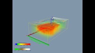
How to get a 3D subsurface image before construction

Karst terrain problems
Cave, Sinkhole, And Void Identification

Groundwater Exploration with Geophysics: for water wells

Ground Magnetic Surveying for Archaeology, Forensics, and Environmental Investigations

Groundwater Exploration

Mineral Exploration

Cemetery Mapping with GPR

3D subsurface investigation for the real estate industry

3D Graveyard Mapping using GPR

Mineral and Mineshaft Exploration

Subsurface & Cemetery Mapping with GPR Before Construction

Geological Assessment Services

3D GPR Cemetery Mapping

Mapping Graveyards with GPR in 3D

Subsurface scanning for construction site investigation

Electrical Resistivity Imaging in Archaeology (The Gault Archeological Site, Central Texas)