Geography Viz
Visual explorations of geography! Extensive use of GIS analyses, remotely sensed imagery, and data plotting. Will cover landforms, climate, hydrology, geology, life, and a geographic perspective on some major news stories. Some focus on the USA, but will build towards more global content. All videos include maps, imagery, and figures!
Help me reach the next milestone:
First video - May 2022
100 views - Jun 2022
1k views - Sep 2022
10 subscribers - Sep 2022
100 subscribers - Dec 2022
10k views - Dec 2022
100k views - Dec 2022 (spiked w Highest Points USA vid even though I was a bit sloppy w that one...)
1k subscribers - Dec 2022 (1st investment - mic, but still struggle w audio - why am I so bad at that?)
500k views - Mar 2024 (spiked w Impact Craters vid)
5k subscribers - Mar 2024
1M views - Apr 2024
10k subscribers - Dec 2024 (and the first vid hitting 1 million views)
2M views - Aug 2025
20k subscribers - ??
3M views - ??

Over 2000 Nuclear Explosions Mapped

Центры США – Географические и демографические центры 48 нижних штатов

Over 2000 Nuclear Explosions Mapped, (3: 1993- & Full Map)

Earth images from space - Volcano edition

Over 2000 Nuclear Explosions Mapped (2: 1960-93), incl. Tsar Bomba

Over 2000 Nuclear Explosions Mapped (1: 1947-60), from Trinity to end of Hardtack II

Latitudes

200 кратеров, образовавшихся в результате ударов о Землю, картографированы по размеру и возрасту

50 Christmas Towns USA (one per state)

Red and Blue Maps (Trump-Biden 2020 Presidential Election)

Earth images from space - Urban edition
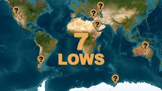
Earth’s 7 Lowest Points by Continent (“Seven Lows”) + Lowest under water & ice + Lowest by countries

7 (или 8+) самых высоких гор Земли по континентам («Семь вершин»)

Most BLUE square km on Earth (by major region)

Most GREEN square km on Earth (by major region)

Most RED square km on Earth (by major region)

The 10 Steepest States of the USA

The 10 Flattest States of the USA

AI image generators make cool/weird maps

Elevations of the USA: The Hypsometric Curve + Hypsometric Tinting

Most Spiraled River Flow Route in USA - Counterclockwise Edition

Most Spiraled River Flow Route in USA - Clockwise Edition

Snow And Surf? Where???

Пространственное соединение — руководство по ArcGIS Pro

Hurricane Tracks by USA County

Lowest Point in Each State of the USA + Geoid and Vertical Relief

Самая высокая точка в каждом штате США + Насколько сложно?

Bluest states of the USA

Greenest states of the USA