Geosearch International
Hi, my name is Andreas de Jong and on this channel I publish educational videos on hydrogeology, hydrology, GIS & data management. I am a freelance consultant in water resources management & associated capacity building of institutions. I will try to answer your questions in the comment section underneath each video, so please don't send me any emails.

Reservoir Capacity Monitoring using the Global Water Monitor dataset

QGIS for Hydrology - Reservoir Elevation-Area-Capacity Curves

QGIS for Hydrology - Catchment Delineation

Мониторинг орошаемых территорий с использованием спутниковых снимков QGIS и Sentinel-2

Как БЕСПЛАТНО загрузить ежедневные данные о погоде со 120 000 станций по всему миру (GHCN-Daily)

How to install SAGA in QGIS - No Binaries needed

Hantush Pumping Test Analysis in Leaky Confined Aquifers

QGIS: Как создать карту контуров грунтовых вод с помощью интерполяции методом тонкослойного сплай...
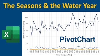
Excel: How to calculate the Seasons & the Water Year

Как оценить потери от испарения из водохранилища, используя бесплатные данные — водохранилище Кад...

Excel: Reservoir Storage Monitoring from Elevation & Area - Kajaki Reservoir

QGIS: Объем водохранилища по DEM – водохранилище Каяки, Афганистан

Excel: How to add a 2nd Axis to a Chart - Reservoir Elevation-Area-Storage Capacity Curves

Excel: How to fix date format problems - Text to Columns, Concatenate & more

Happy New Year 2022 & thanks for your support in 2021!

Snow Covered Area & Water Resources - Kajaki Dam Catchment, Afghanistan

Snow Water Volume & Water Resources - Kajaki Dam catchment, Afghanistan

Introduction to Snow Monitoring in River Basins (Snow Water Equivalent & Snow Covered Area)

Evapotranspiration: Download FREE daily MODIS ET/PET over a catchment in AppEEARS & process in Excel

Introduction to MODIS Evapotranspiration (MOD16) - a free global dataset of ET & PET

Технические условия и спецификации объемов работ (ТЗ и ВОР) для скважин на воду - Гидрогеология 101

QGIS 101: Отмывка по ЦМР

Climate Engine: Download FREE Daily CHIRPS precipitation data over a catchment (drainage basin)

QGIS 101: Extract the Streams - Mapping catchments & streams from DEM - Part 3 of 3

QGIS 101: Map the Catchment - Mapping catchments & streams from DEM - Part 2 of 3

QGIS 101: Подготовка ЦМР — Картографирование водосборов и водотоков на основе ЦМР — Часть 1 из 3

QGIS 101: Georeferencing maps using satellite images

Hydrogeology 101: GeoVES - Free 1D VES inversion for groundwater exploration

Гидрогеология 101: Введение в электроразведку