Virginia Geospatial Extension
The Virginia Geospatial Extension Program (based at Virginia Tech), in partnership with VirginiaView, GeoTEd-UAS, Virginia Cooperative Extension, and other collaborators, develops and disseminates GIS, GNSS, remote sensing, and sUAS educational resources. Instructional geospatial video tutorials are provided via the Virginia Geospatial Extension Program YouTube Channel. Access to additional geospatial educational resources (including books, ebooks, curriculum, learning lessons, etc.) is provided via the VirginiaView Website (htps://www.virginiaview.net).
Chapter 22 Introduction to Supervised Classification of a Landsat 9 Image

Chapter 21 Unsupervised Classification of a Landsat 9 Image

Chapter 20 Change Detection Using Landsat 9 Imagery

Chapter 19 Spectral Enhancement of Landsat 9 Imagery

Chapter 18 Spatial Enhancement of Landsat 9 Imagery

Chapter 17 Radiometric Enhancement of Landsat 9 Imagery

Chapter 16 Band Combinations For Landsat 9 Imagery

Chapter 15 Subsetting a Landsat 9 Composite Image

Chapter 14 Creating a Composite Image Using Landsat 9

Chapter 13 Displaying Landsat 9 Imagery in ArcGIS Pro

Chapter 12 Information About Downloaded Landsat 9 Image

Chapter 11 Downloading Landsat 9 Imagery using EarthExplorer

Chapter 10 Imagery Available from the United States Geological Survey

Using GNSS In Agriculture
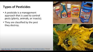
Intro To Agriculture Pesticides And Herbicides

Introduction To Agriculture-Basic Concepts
Introduction to Agriculture - Understanding Basic Concepts

Precision Agriculture - Introduction to Pesticides and Herbicides

Chapter 24 Using Surface Constraints

Chapter 23 - Creating Surface Constraints

sUAS Flight Planning Weather Briefing Part 6.2

sUAS Flight Planning Fixed Wing Part 3

sUAS Flight Planning Digital Scouting Part 2

sUAS Flight Planning Weather Briefing Part 6.1

sUAS 3D Model and Linear Flight Plans Part 5

sUAS Flight Planning Rotor Part 4

sUAS Flight Planning Part 1

Chapter 22 - Creating a Digital Elevation Model

Chapter 19 - Interactive Classification

Chapter 21 - Classifying Points Using Geoprocessing Tools