How I Found Hidden 1950s Boundary Marks Using New Survey Tech 🧭⭐
Автор: The Global Surveyor
Загружено: 2025-04-10
Просмотров: 767
These 1950s survey marks are almost completely lost… but can I still find them in the middle of suburban Sydney?
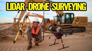
In this fast-paced, 8-minute episode, I head to St Ives, Northern Sydney to search for survey marks placed over 70 years ago — many now buried under gardens, roads, and driveways. Using cutting-edge Leica technology — including the Leica GS18 GPS Rover and AP20 SmartPole — I try to bring these hidden marks back to life.
Join me as I blend historic land surveying methods with modern GPS precision to uncover what time and development have tried to erase. It’s a real-world mix of fieldwork, history, detective work, and surveying gear — perfect for anyone into surveying, Leica gear, or old benchmarks.
📍 Location: St Ives, Sydney, NSW
🛰️ Equipment: Leica GS18, Leica AP20 AutoPole, iPhone XR, Insta360 X3
🎥 Channel: The Global Surveyor
👉 Love old survey marks, GPS tech, or historic field adventures?
Hit Like, tap Subscribe, and drop a comment — I read them all!
💬 Got Questions?
Have you worked with a LeicaAP20 or GS18 before? Let me know your experiences in the comments below!
I don’t make this content for self-gratification or attention — I do it because I genuinely believe surveying is an incredible and often overlooked field. My goal is to share knowledge, spark curiosity, and help people better understand what we do as surveyors. If I can make a living from this along the way, that’s fantastic. But if I can inspire more people, help students, or even just make someone’s day a bit more interesting by showing them something new — that means even more.
If any of that inspires you, feel free to like, share, subscribe, or even donate — it all helps me keep doing what I love while helping others along the way. Thanks for being part of the journey.
DONATE TO THE CHANNEL - help me to continue making great content.
https://paypal.me/globalsurveyor
CAN I PROMOTE YOUR SURVEYING PRODUCT? Leica, Trimble, Topcon or any type of surveying related accessory or equipment! Contact me to discuss!
🧭 GEAR I USE:
🔴 Leica GS18 & GS15 – The powerhouse behind precise GNSS work
🛠️ Supplied by CR Kennedy Australia (Leica Geosystems)
https://survey.crkennedy.com.au/
Contact Kristine Z from CRK - Sydney office for sales and advice.
🎓 INTERESTED IN BECOMING A SURVEYOR?
Check out the Industry Training Alliance — they offer an excellent Cert IV leading to a Diploma of Surveying that’s helped many kick off their careers. https://www.ita-au.edu.au/diploma-of-...
WANT TO FIND OUT ABOUT SURVEYING CAREERS? - https://www.surveyingcareers.com.au
💻 THIS SURVEY SOFTWARE I USE:
miniCAD by Mapsoft – Simple, efficient, and built for fieldwork!
The worlds most affordable surveying software!
👉 https://www.mapsoft.com.au
STARRY STARRY DAY - THE APP
✅ Just 99 cents AUD — Google Play.
https://play.google.com/store/apps/de...
👣 Follow My Adventures on TikTok:
🎵 @theglobalsurveyor
👍 Like, Subscribe & Drop a Comment
Let me know if you'd love to see more old marks, wild terrain, or bush adventures — thanks for watching!
🌿 Support the Channel 🌿
Super Chats, Super Stickers, Super Thanks, and Memberships are now available! Your support helps keep these surveying adventures coming. Tap the 💲 icon or the JOIN button to learn more.

Доступные форматы для скачивания:
Скачать видео mp4
-
Информация по загрузке: