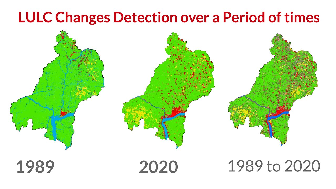
Landuse and Landcover Classification with Change detection using Machine Learning SVM classification
Автор: Study Hacks-Institute of GIS & Remote Sensing
Загружено: 2022-09-10
Просмотров: 2870
Landuse and Landcover Classification with Change detection using Machine Learning SVM classification
Start with Google Earth Engine & Spatial Analysis beginners 20th batch.
Registration is open for the 'Online Training on Google Earth Engine (GEE) for Remote sensing Analysis for Beginner, 20th Batch.
Online training program Conducted by Study Hacks (Institute of GIS & Remote sensing)
Take advantage of this discount and register very first!!!
Register 1st 5 People to get a 50% Discount.
Classes will be via Zoom on the 24th, 25th & 26th of September from 9.00 pm until 12.00 AM (BD time) or 21:00 to 00:00 (GMT+6);
Class Duration: 3 hours
For booking Your Seat Contact this WhatsApp Number: +8801780942798 or Email: rmijanur10266@gmail.com
Online Training on Google Earth Engine (GEE) for Remote sensing Analysis for Beginners, 20th Batch, this class will teach you all the things you need to start using GEE for your remote sensing analysis. We mainly focus on these people who don't know any programming language and Earth Engine function. After completing this course, you can do any Remote sensing analysis very quickly and efficiently using the Google Earth Engine Platform. We cover LULC mapping, Air quality, Monitoring, Time series analysis, Calculating any Indices, Supervised Classification, Machine Learning Methods, and more.
Course Content:
1) Introduction to Google Earth Engine, How to create a verified Earth Engine account
2) Basic JavaScript Programming Language
3) Client VS Server Object: Earth Engine Server Function
4) Filtering visualizing satellite imagery: Landsat, Sentinel, Modis
5) Importing and Exporting Raster and Vector data
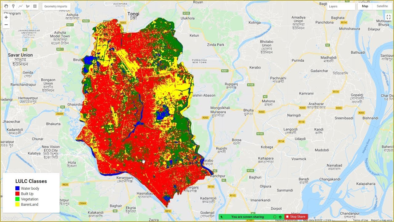
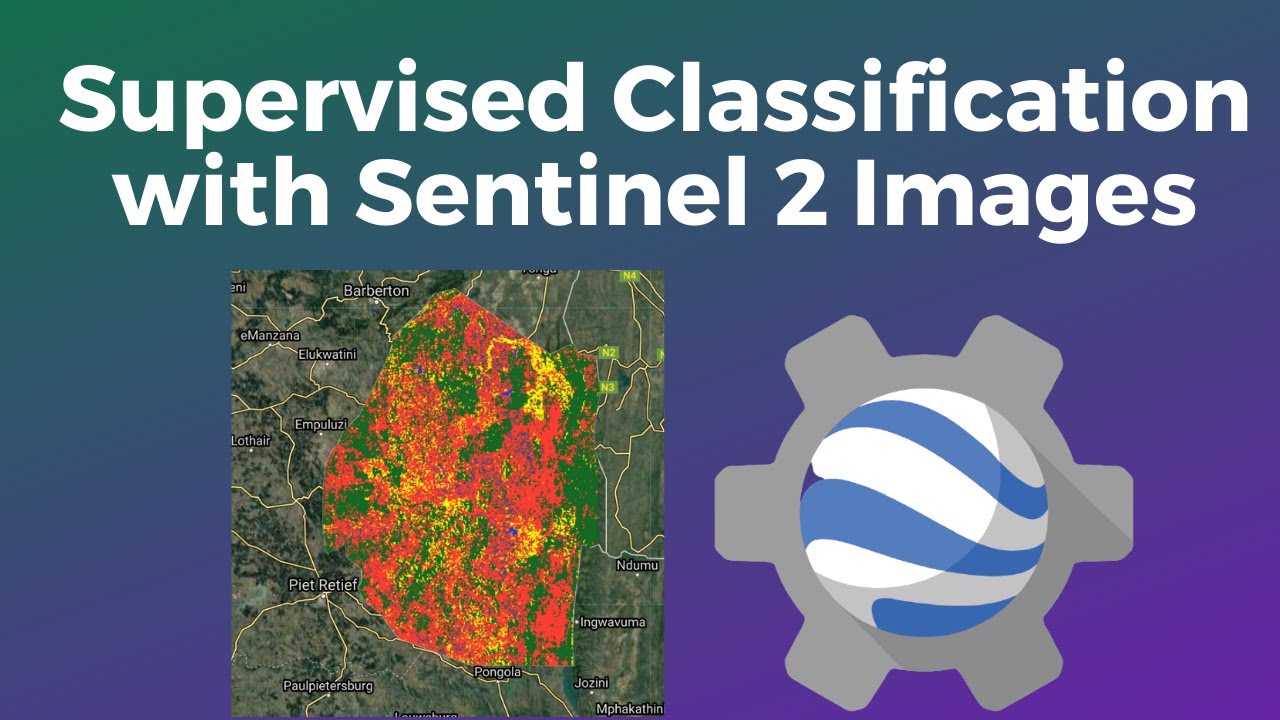
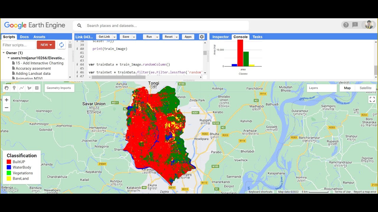
6) Making Landuse and LandCover Classification Map in GEE
7) Computation with satellite imagery: Band Calculations
8 ) Making a time series Chart analysis
9) Air Quality Monitoring using sentinel-5
10)Spectral indices and develop the Skills for calculating any Index (NDVI, NDWI, NDSI, MNDWI, MSAVI, etc.)
💲 Course Fee: 400$ / 18000 INR / 16,000 BDT / 1000 Ethiopian Birr(✌Take advantage of this discount for the First 5 people can join this course 50% discount only 200$ / 9000 INR / 8000 Bangladeshi Taka / 4000 Ethiopian Birr
)
For booking Your Seat Contact this WhatsApp Number: +8801780942798 or Email: rmijanur10266@gmail.com
Take advantage of this discount and register very first!!!
There are already over 150+ students who have taken part in our training and courses and many are already developing their own codes and research with the GEE
.Join Our Community:
Join our official YouTube Channel: / @gisrsinstitute
Join our official Facebook Page: / studyhackseducationcenter
Join Telegram group: https://t.me/gisandremotesenginglearn...
Join What's App Group: https://chat.whatsapp.com/DJyR6BjhnBa...
Join Skype Group: https://join.skype.com/ym0c1b7bjxHH/
Join our Facebook page: / studyhackseducationcenter
Join our Instagram: / study_hacks_geoscience_world
#gis #remotesensing #googleearthengine #EarthEngine #community #people #data #javascript #research #programming
Доступные форматы для скачивания:
Скачать видео mp4
-
Информация по загрузке: