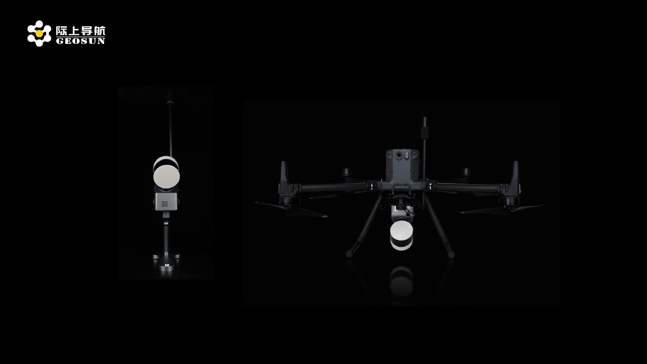
GS-130G SLAM LiDAR | From Handheld to UAV to Underground — True Sky-to-Ground Integration
Автор: Geosun Navigation
Загружено: 2025-08-20
Просмотров: 416
Discover how the Geosun GS-130G redefines 3D mapping with the concept of “Sky-to-Ground Integration.”
The GS-130G is more than a handheld SLAM LiDAR device — it extends seamlessly to UAV missions and excels in underground mapping, delivering unmatched versatility in one compact solution.
Key Features:
✔️ Ultra-long ranging capability for large-scale coverage
✔️ ±1 cm accuracy and 1.92 million points per second capture rate for dense, reliable 3D data
✔️ GNSS+INS fusion algorithm and AGC adaptive technology for stable results without relying on speed or environmental features
✔️ Seamless performance in indoor, outdoor, aerial, and underground environments
✔️ All packed in one portable suitcase
From the sky to the ground, from confined tunnels to wide open airspace, the GS-130G makes professional mapping simpler, smarter, and more flexible than ever.
🔔 Subscribe to our channel for more cutting-edge LiDAR innovations.
👉 Learn more: www.geosunlidar.com
Geosun GS-130G, SLAM LiDAR, 3D Mapping System, Handheld LiDAR, UAV LiDAR Mapping, Underground Mapping, Point Cloud Technology, GNSS+INS Algorithm, AGC Adaptive Algorithm, Surveying Equipment, Mobile Mapping, High Precision LiDAR
#SLAMLidar #3DMapping #Surveying #LiDARTechnology #GeosunGS130G #UAVMapping #HandheldLiDAR #IndoorMapping #UndergroundMapping#GEOSUN
Доступные форматы для скачивания:
Скачать видео mp4
-
Информация по загрузке: