Скачать
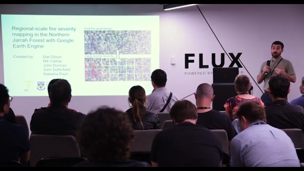
FOSS4G Perth - Dan Dixon - Fire severity mapping with Landsat and Google Earth Engine
Автор: FOSS4G SotM Oceania
Загружено: 2021-12-21
Просмотров: 189
Описание:
This talk will explore the use of Google Earth Engine for mapping the severity (level of crown scorch) of wildfires and prescribed burns in southwest Australia. Specifically, I will cover the benefits of using Earth Engine for mapping the entire catalog of fires over the past 16 years.
FOSS4G Perth 2021 took place on 12 November 2021 in Perth, Western Australia. It’s a community-driven event focused on open geospatial, including open source software and open data, with a mission to build a strong local community by bringing people together to share stories and welcome newcomers. Find out more here: https://foss4g-perth.org
Доступные форматы для скачивания:
Скачать видео mp4
-
Информация по загрузке: