Скачать
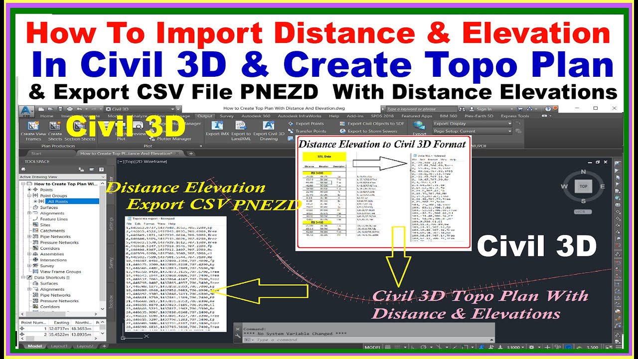
How to Import Distance & Elevations in Civil 3D & Create Topo Map.| Export CSV PNEZD File.
Автор: Surveying Engineering Design Information
Загружено: 2022-10-15
Просмотров: 2469
Описание:
This Video about Autocad Civil 3D in this Video Working of NSL File With Distance Elevations Import Process of Civil 3D and Create Topography Drawing . and Mark Points Descriptions and Export Fine into Coordinated PNEZD CSV File Format. Very useful for Civil 3D Users.
Create Point Alignment in Civil 3D
Create Points Distance & Elevation in Civil 3D
Example Files & Drawings Download Link.
https://drive.google.com/file/d/1vXiE...
#civil3d #topographie #Importexportcivil3d #distanceelevationimport #AlignmentpointsCivil3D
Доступные форматы для скачивания:
Скачать видео mp4
-
Информация по загрузке: