A Quick Overview of Plex-Earth - 2025 Edition
Автор: Plex-Earth
Загружено: 2024-07-27
Просмотров: 6055
🔍 Looking to take your CAD projects to the next level?
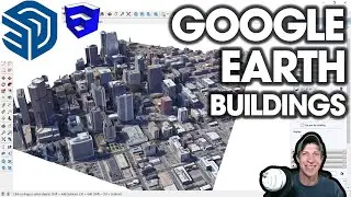
With Plex-Earth, you can effortlessly import satellite and aerial imagery, terrain data and even visualize your designs in Google Earth.
In this short introductory video, we will explore all the unique features of Plex-Earth 2025:
00:00 - Introduction
00:52 - Satellite and Aerial Imagery 🗺️
05:25 - Terrain Elevation Data 🏞️
09:15 - Site Areas & Points of Interest 📍
14:16 - Google Earth Tools (KML&KMZ) 🌍
15:51 - Georeference 🌐
17:10 - Conclusion
Want to try it yourself? Download Plex-Earth 2025 from here:
https://plexearth.com/free-trial
For any questions, feel free to contact us at support@plexscape.com

Доступные форматы для скачивания:
Скачать видео mp4
-
Информация по загрузке: