Using Google Maps as a Reference Mesh in SynthEyes
Автор: Boris FX Learn
Загружено: 2024-09-04
Просмотров: 293
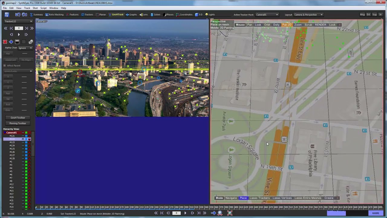
In this tutorial, Russ Andersson demonstrates how to match a solved scene with a reference model in SynthEyes. Using a helicopter flyover shot and a textured plane from Google Maps as the reference, Russ walks through the process of tracking and solving the scene. He begins by running the auto tracker and removing moving vehicles to ensure accurate tracking. He explains the importance of adding supervised trackers at specific locations visible in both the footage and the reference model. Russ highlights the use of the "place mode" to position trackers accurately on the reference mesh and generate precise XYZ coordinates. He then shows how to adjust and refine the solve, taking into account the constraints and discrepancies between the shot and the reference model. This method can also be applied to full 3D models, making it versatile for various architectural and mapping projects.
Доступные форматы для скачивания:
Скачать видео mp4
-
Информация по загрузке:


