Скачать
ArcGIS Pro: Multiple Spatial Joins for Counts to Identify Top Neighborhoods
Автор: Grant's Crime Lab
Загружено: 2023-05-02
Просмотров: 909
Описание:
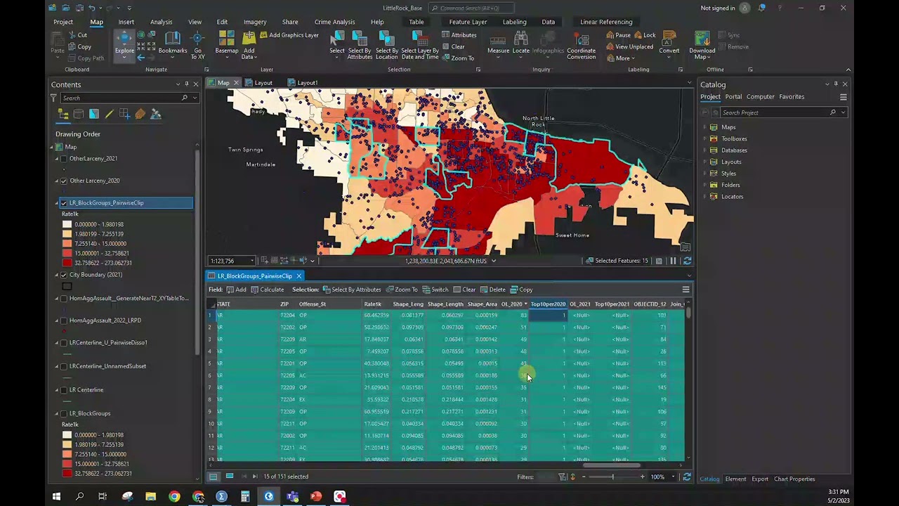
Have a student working on a project wanting to identify top neighborhoods for crime across multiple years. This video covers how to do multiple spatial joins of crime counts within block groups in Little Rock. The video provides a couple different ways to obtain the count during the Spatial Join. I then cover how to identify the top 10% of neighborhood and dummy code those with "1". After this is done for 2020 and 2021, I work on the symbology, mostly with the transparency to indicate similarities and differences across the two years.
Доступные форматы для скачивания:
Скачать видео mp4
-
Информация по загрузке: