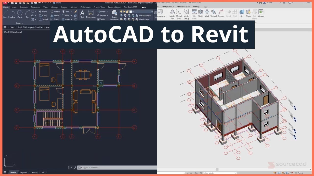
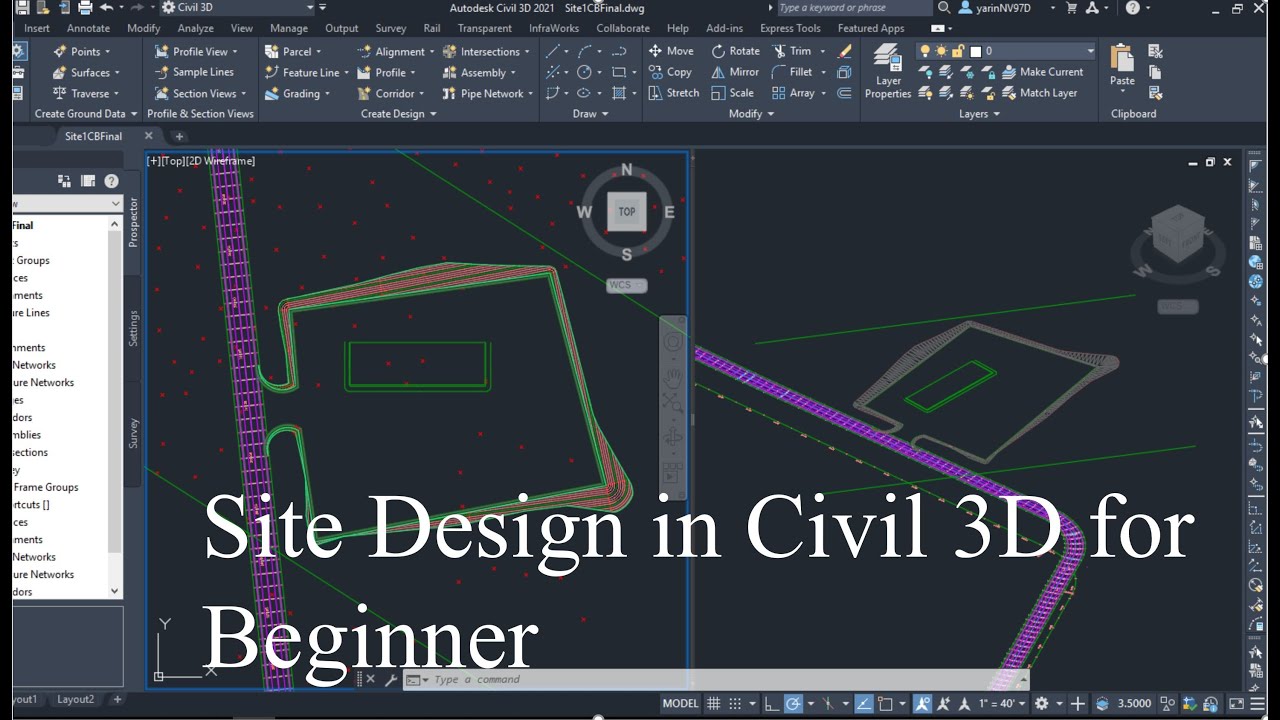
How to create a Revit site plan using Civil 3D CAD survey files
Автор: SourceCAD
Загружено: 2025-06-30
Просмотров: 1608
Learn Revit architecture right from scratch in the free Revit architecture essentials course and get a certificate of completion when you finish the course: https://sourcecad.com/courses/revit-e...
Learn Civil 3D right from scratch in the free Civil 3D essentials course and get a certificate of completion when you finish the course: https://sourcecad.com/courses/civil-3...
Struggling to get accurate site plans into Revit?
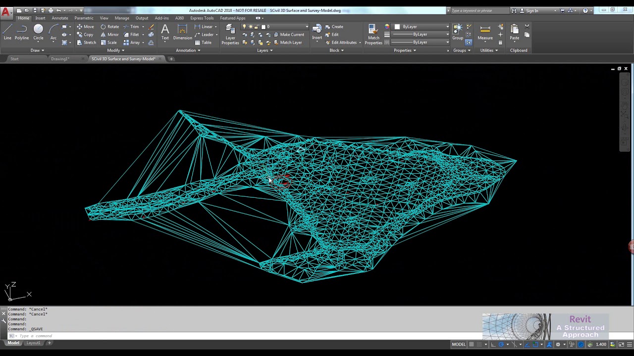
You’re not alone, but this tutorial is here to change that. In this step-by-step video, you’ll learn exactly how to bring Civil 3D survey files into Revit and create a clean, precise site plan that aligns with real-world project conditions.
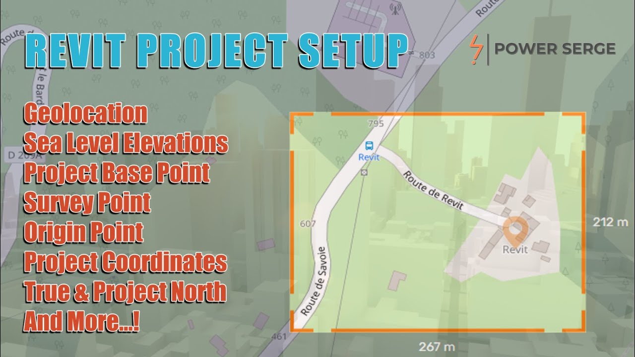
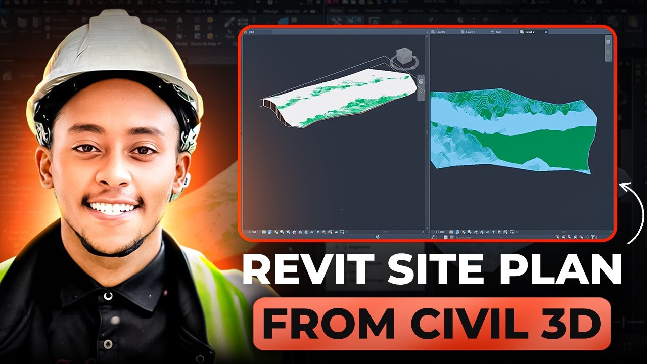
We cover everything: exporting from Civil 3D, linking CAD files into Revit, setting correct units and project coordinates, transforming CAD data into Revit toposolids, and adjusting levels for smooth modeling.
Whether you’re an architect, engineer, or Revit learner, this is the upgrade you’ve been waiting for to move beyond placeholder sites and manual tracing.
Want to sharpen your Revit skills further? Check out our free Revit Architecture Essentials course (link in the description).
It’s designed to take you from beginner to confident project builder, and you’ll even get a certificate when you finish.
Have a Revit topic you want us to cover next? Drop your suggestions in the comments. We’re always listening!
00:00 Intro
00:50 Selecting your Topographical map in Civil 3D
02:25 Configuring Civil 3D project link CAD settings
06:00 Configuring Civil 3D project export settings to AutoCAD
09:26 Linking AutoCAD DWG file to Revit
11:01 Creating Revit Toposurface using Linked AutoCAD file
13:17 Level datum lines
15:54 Changing project units
16:55 Outro
Доступные форматы для скачивания:
Скачать видео mp4
-
Информация по загрузке: