RTK, NTRIP & PPK Explained: How GNSS Achieves Centimeter-Level Accuracy
Автор: Offshore Surveys
Загружено: 2022-04-07
Просмотров: 14380
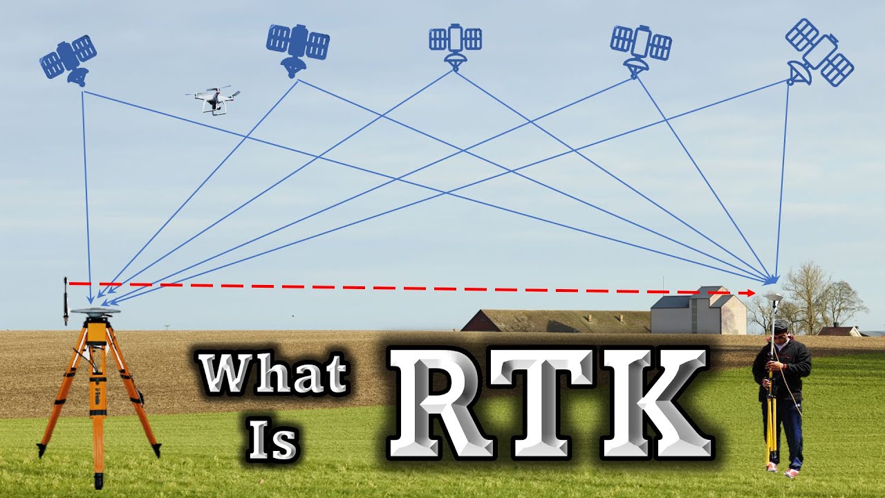
Want to unlock centimeter-level positioning accuracy with GNSS? 🛰️ In this video, we break down how RTK (Real-Time Kinematic) works, why atmospheric errors affect GPS signals, and how advanced techniques like NTRIP and PPK help surveyors achieve pinpoint precision — even in challenging environments.
🎯 What you'll learn:
What RTK is and how it improves GNSS accuracy
Why standalone GPS receivers can’t beat atmospheric errors
How base and rover receivers work together to eliminate signal delays
The role of pseudo-range and carrier phase measurements
How ambiguity resolution and signal phase tracking boost precision
RTK baseline limits for single-band and multi-band receivers
How NTRIP networks deliver real-time corrections over 3G/4G
Why PPK (Post-Processing Kinematic) is a reliable fallback when real-time data isn’t available
📡 Whether you're surveying on land, near coastlines, or inside rivers and channels, this video gives you the complete picture of how modern GNSS systems achieve sub-centimeter accuracy — and what tools and techniques you need to get there.
🎓 This video is part of the "GNSS Fundamentals" series on Offshore Surveys — your trusted resource for mastering satellite navigation, geodesy, and precision surveying.
#RTKSurveying #GNSSAccuracy #NTRIPExplained #PPKTechnique #GPSPrecision #SurveyingTips #CarrierPhase #BaseAndRover #GNSSFundamentals #OffshoreSurveys
Доступные форматы для скачивания:
Скачать видео mp4
-
Информация по загрузке:


