Besiktas, Istanbul, Turkey 🇹🇷, 4K
Автор: Walking Everywhere 4K
Загружено: 2023-11-14
Просмотров: 545
Beşiktaş is a district and municipality of Istanbul Province, Turkey. Its area is 18 km2, and its population is 175,190 (2022). It is located on the European shore of the Bosphorus strait. It is bordered on the north by Sarıyer and Şişli, on the west by Kağıthane and Şişli, on the south by Beyoğlu, and on the east by the Bosphorus. Directly across the Bosphorus is the district of Üsküdar.
The district includes a number of important sites along the European shore of the Bosphorus, from Dolmabahçe Palace in the south to the Bebek area in the north. It is also home to many inland (and relatively expensive, upper-middle class) neighborhoods such as Levent and Etiler. Some of its other well-known neighborhoods include Yıldız, Kuruçeşme, Ortaköy, and Arnavutköy.
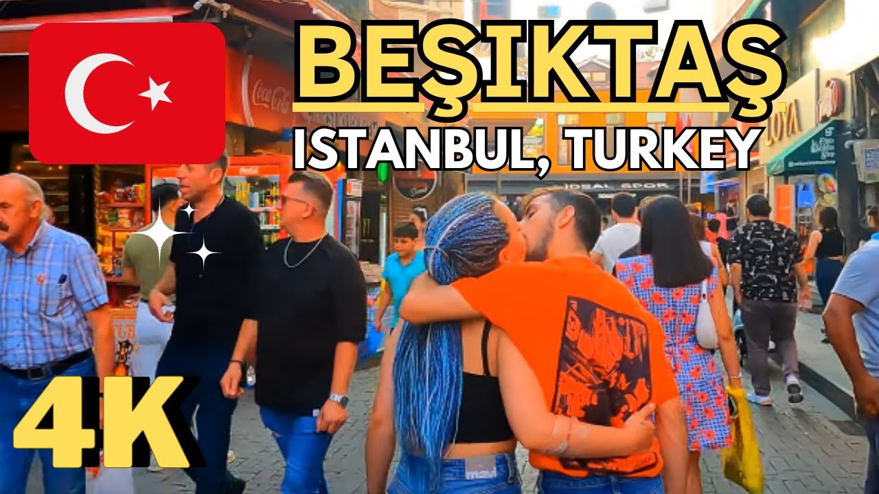
Beşiktaş' historic commercial centre is the Beşiktaş quarter and Çarşı (literally, "marketplace"), which adjoins the small Abbasağa Park. Running in the north–south direction, Barbaros Boulevard is a major feeder road for the inner-city motorway Otoyol 1 and the Bosphorus Bridge, terminating at the important public transport hub of Zincirlikuyu. Büyükdere Avenue also runs through the district.
Although it is a relatively small district of Istanbul, both in terms of population and area, Beşiktaş is one of the city's most important areas due to its business and shopping areas, historic sites, universities, scenic views of the Bosphorus strait, and feeder roads for the Bosphorus and Fatih Sultan Mehmet bridges passing through it. The district is also the leading financial center of Turkey.
In a 2013 ranking of Turkish districts, Beşiktaş placed first overall due to its high quality of life, prosperity, and cultural level.[6] Beşiktaş is also the highest ranking Turkish district in terms of the Human Development Index, with an HDI of 0.864, while also ranking first in the individual indexes for income and education. The municipality is taking part in the Cities4Europe campaign and has qualified as a "European 12 Star City".
Name
The district takes its name from the Beşiktaş quarter located in the modern-day Sinanpaşa neighborhood. Along with Çarşı, this historic center is sometimes referred to as Köyiçi (roughly "inner village") by locals.
The word beşik means "cradle" in Turkish, while taş means "stone".
According to one story, there was a Byzantine church in modern-day Beşiktaş with the name Kounopetra, Greek for "stone cradle". The church was built to honor a relic, a stone reportedly taken from the stable in Bethlehem where Jesus was born. This stone was later relocated to Hagia Sophia and disappeared during the Fourth Crusade, possibly to be sold in Europe's relics market.
Another story states that a cleric from a Saint Menas (Aya Menas) Church where Beşiktaş now is returned from a pilgrimage to Jerusalem with a cradle-shaped stone used in the baptism of Jesus and placed it in the church.
One other explanation is that the name is a corruption of beş taş, Turkish for "five stones", referring to the five stone pillars built to moor ships by Barbarossa Hayreddin Pasha.
Beşiktaş (pron. beshíktash) es un distrito de Estambul, principal ciudad de Turquía (cuya capital es Ankara), localizado en la parte europea de dicha ciudad, junto a la costa del Bósforo. El ayuntamiento de Beşiktaş, integrado en la Municipalidad de Estambul (İstanbul Büyükşehir Belediyesi) administra varios subdistritos y barrios situados en la línea de costa que recorre el Bósforo, en su lado europeo, así como las colinas situadas frente a este estrecho (desde el antiguo Palacio imperial otomano de Dolmabahçe hasta el barrio de Bebek). El distrito alberga algunos de los barrios o localidades más conocidos de Estambul, como Arnavutköy, Balmumcu, Bebek, Etiler, los distintos subdistritos de Levent, Ortaköy, Ulus, y Yıldız. Beşiktaş tiene una población de 185.373 (2008).
Beşiktaş, İstanbul'un bir ilçesidir. Adını İstanbul'un en eski semtlerinden biri olan Beşiktaş semtinden alır. 8,4 km uzunluğunda sahili olduğu İstanbul Boğazı’nın Rumeli yakasında yer alan ilçe batıda Şişli ve Kâğıthane, güneybatıda Beyoğlu, kuzeyde Sarıyer ilçeleriyle komşudur. Yüzölçümü 18 km², nüfusu ise 2019 ADNKS verilerine göre 182.649'dur.
Hem nüfus, hem de alan olarak İstanbul kentinin küçük ilçelerinden biri olmasına karşın iki kıtayı ve İstanbul'un iki yakasını birbirine bağlayan 15 Temmuz Şehitler Köprüsü ve Fatih Sultan Mehmet köprülerinin bağlantı yolları, sahip olduğu son dönem Osmanlı mimarisi eserleri, Boğaziçi yamaçları, üniversiteler ile çeşitli bölüm ve fakülteler ve Levent-Maslak hattındaki iş merkezleri nedeniyle gündüz nüfusunun sayım nüfusuna göre birkaç misli arttığı bir alandır. Türkiye Cumhuriyeti Sanayi ve Teknoloji Bakanlığı'nın yaptığı araştırmaya göre Türkiye'nin en gelişmiş 3. ilçesi seçilmiştir.
Доступные форматы для скачивания:
Скачать видео mp4
-
Информация по загрузке: