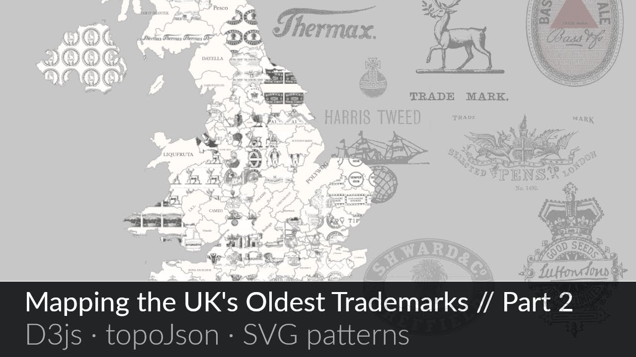
Mapping the UK's oldest trademarks // Part 2: Visualising the data
Автор: Creating with Data
Загружено: 2023-04-19
Просмотров: 60
This video is part 2 of 2 of re-creating this map visualisation of the UK's oldest trademarks (see here: https://creating-with-data.glitch.me/... ).
In this video, we visualise the trademarks data we gathered in part 1 using d3js by rendering a map of the UK with postal area boundaries and then filling each of them with the accompanying trademark label and image as background pattern.
For code and notes see: https://creatingwithdata.com/mapping-...
Part 1 can be found here: (data-prep with SQLite) is over here: • Mapping the UK's oldest trademarks // Part...
0:00 Introduction
1:59 Starter map code walkthrough
11:28 Fetching trademarks data and rendering text labels
14:59 Centring and scaling labels over boundary paths
19:02 Path backgrounds with the pattern element
22:59 Dynamically creating patterns with trademark data
31:54 Scaling path backgrounds
33:55 Using path.area to scale font-sizes to boundaries
Доступные форматы для скачивания:
Скачать видео mp4
-
Информация по загрузке:


![1 A.M Study Session 📚 [lofi hip hop]](https://image.4k-video.ru/id-video/lTRiuFIWV54)


