Sunnyside Homestead: The Donation Land Claim of Jacob Ebey, the Ferry House and Ebey’s Prairie
Автор: Searching for History
Загружено: 2025-08-03
Просмотров: 437
We explore the Sunnyside Homestead at the Ebey’s Landing National Historical Reserve, on Whidbey Island, Washington.
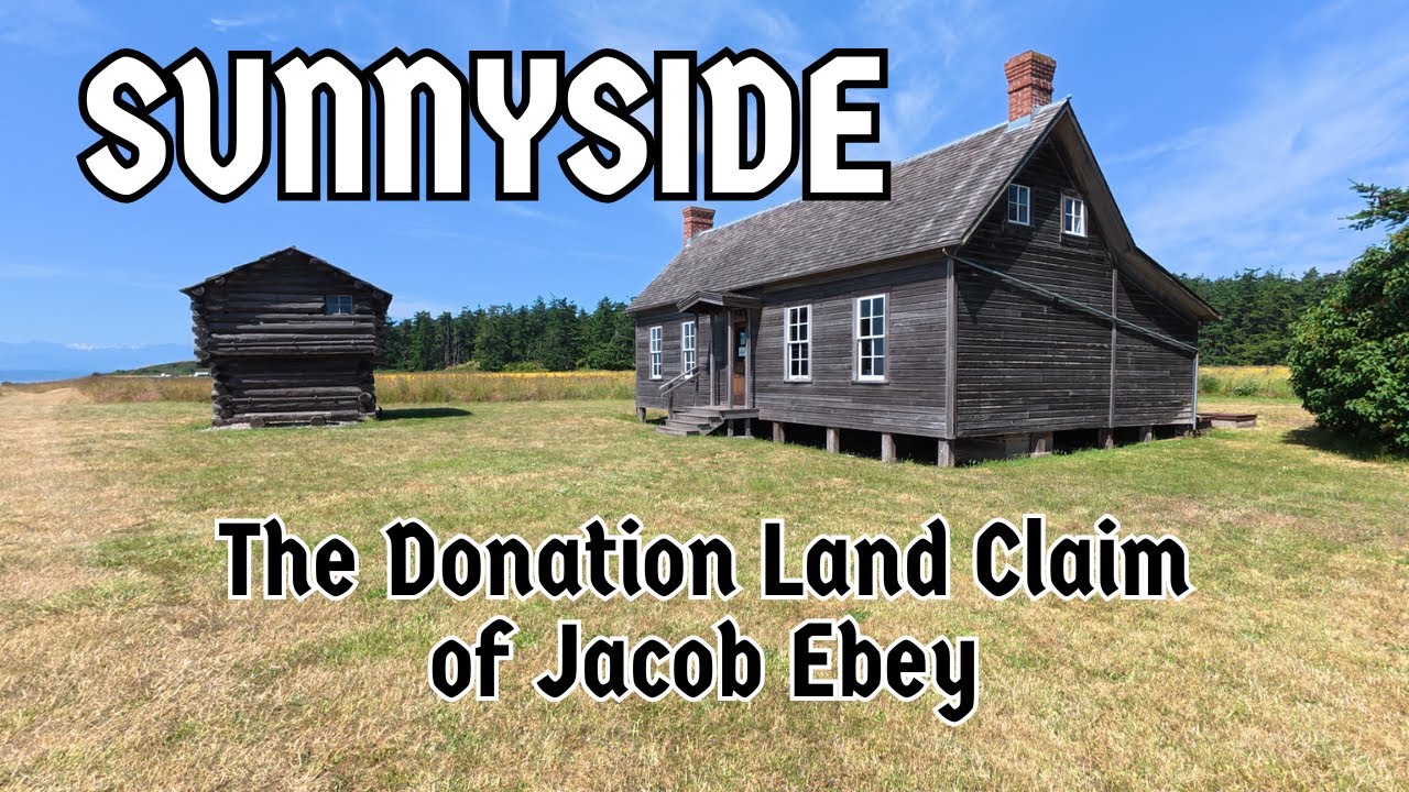
On this episode of Searching for History, Erin and I visit the Sunnyside Homestead at Ebey’s Landing National Historical Reserve on Whidbey Island, Washington. Sunnyside Homestead was the name Jacob Ebey gave to his donation land claim. While there we visit the Sunnyside pioneer cemetery, the Ebey house and blockhouse, the ferry house and ponder life on the beautiful Ebey’s prairie. If you are on Whidbey Island, this is a must see. Join us as we explore, the Sunnyside Homestead!
#abandonedplaces
#whidbeyisland
#washingtonstate
Music Attributions
Song 1: To the Top by Silent Partner (YouTube Audio Library License, no attribution is required)
Song 2: Hero’s Ascent by Chris Haugen (YouTube Audio Library License, no attribution is required)
Song 3: The Golden Present by Jesse Gallagher (YouTube Audio Library License, no attribution is required)
Song 4: Spanish Moss by Chris Haugen (YouTube Audio Library License, no attribution is required)
Song 5: Birdseye Blues by Chris Haugen (YouTube Audio Library License, no attribution is required)
Song 6: Natural Light by Chris Haugen (YouTube Audio Library License, no attribution is required)
Image Attributions
Image 1: Unknown Photographer. C.1850 photograph of Isaac Neff Ebey (1818-1857). Circa 1850. This image is in the public domain. Image located: https://en.wikipedia.org/wiki/File:Is....
Image 2: Unknown illustrator (Cassier’s Magazine). USS Massachusetts (ships, 1845) - Cassier's 1894-12. Circa 1894. This image is in the public domain. Image located: https://commons.wikimedia.org/wiki/Fi....
Image 3: Department of the Interior, General Land Office. Cadastral Survey Plat, Township No. 31, North, Range No. 1 East Willamette Meridian. Surveyor Generals Office, Olympia, Washington Territory. December 4th, 1856. Image located: https://www.blm.gov/or/landrecords/la....
Image 4: Department of the Interior, General Land Office. Cadastral Survey Plat, Township No. 31, North, Range No. 1 East Willamette Meridian. Surveyor Generals Office, Olympia, Washington Territory. March 31st, 1863. Image located: https://www.blm.gov/or/landrecords/la....
Image 5: Wilkes, Charles. Map of Oregon Territory. 1841. Washington, D.C.: U.S. Dept. of Commerce, National Oceanic and Atmospheric Administration. This image is in the public domain. Image located: https://www2.sos.wa.gov/legacy/maps/m....
Image 6: Hide, L. Black soil prairie. 2012. U.S. National Park Service. This image is in the public domain. Image located: https://npgallery.nps.gov/AssetDetail....
Image 7: Photographer not listed. Sunrise over Ebey’s Prairie. 2016. U.S. National Park Service. This image is in the public domain. Image located: https://npgallery.nps.gov/AssetDetail....
Image 8: Stanley, John M. Puget Sound & Mt. Rainier Whitby’s Island. 1854. Imagine from Yale University Art Gallery. This image is in the public domain. Image located: https://artgallery.yale.edu/collectio....
Image 9: Photographer not listed. The Ferry House and Straight of Juan de Fuca. 2016. U.S. National Park Service. This image is in the public domain. Image located: https://npgallery.nps.gov/AssetDetail....
Image 10: Hide, L. Gray day at Ferry House. 2012. U.S. National Park Service. This image is in the public domain. Image located: https://npgallery.nps.gov/AssetDetail....
Image 11: Photographer not listed. Geese at Ferry House. 2008. U.S. National Park Service. This image is in the public domain. Image located: https://npgallery.nps.gov/AssetDetail....
Доступные форматы для скачивания:
Скачать видео mp4
-
Информация по загрузке: