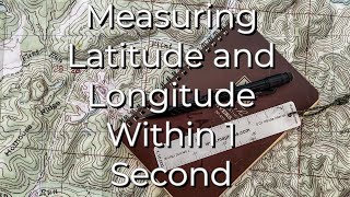
How do I use the Latitude Scale to Measure Distance on a Mercator Marine Chart?
Автор: Free Sailing Tutorials
Загружено: Дата премьеры: 29 янв. 2021 г.
Просмотров: 4 334 просмотра
⇩ 🆓 Never forget the important stuff again! Download my FREE Pre-Departure & Engine Checklist Dynamic PDF (normally £4.95) when you subscribe to my website for FREE! https://www.freesailingtutorials.com/...
ABOUT MARK
I'm a professional sailor & RYA Yachtmaster™ Instructor (Ocean) with over 35 years experience. I've logged over 250,000 nautical miles including competing in three round-the-world yacht races, twice as skipper. I circumnavigated in 2011 on an Ed Dubois designed Clipper 68 and subsequently skippered two Tony Castro designed Clipper 70's in the Clipper Round the World Yacht Race in 2013 and 2019, respectively.
I've raced in the Southern Ocean nine times, crossed the North & South Atlantic 8 times and the Pacific 3 times. I've also skippered the RORC Rolex Fastnet Race three times and the Rolex Sydney Hobart Race, Swan World Cup and many other regattas and offshore races including Cowes Week & Marmaris.
FREE SAILING TUTORIALS is not an official RYA accredited training centre. All views my own. Admiralty Copyright License: HMCO 35358
WEBSITE: https://www.freesailingtutorials.com
FACEBOOK: / freesailingtutorials
PODCAST: https://www.anchorfm.com/captainsvlog
If you're getting value from these free videos & would like to throw me a tip, you can tip me the price of a coffee here: https://donorbox.org/free-sailing-tut... or you can click the Youtube 'thanks' button under this video.
IMPORTANT DISCLAIMER:
I am an RYA Yachtmaster Instructor. Videos are for free guidance only. Always seek advice before taking action. Videos on my channel are not provided in context and as such cannot and do not form part of a formal navigational and sailing course and should not be relied upon as such. This content is offered free of charge and I accept no liability for any reliance placed upon the content of these videos or references, therein. There is no contract between me and the viewer as a result of visiting this channel or watching these free videos.
AFFILIATE LINKS:
*This description may contain affiliate links to products we enjoy using ourselves. Should you choose to use these links, this channel may earn affiliate commissions at no additional cost to you. We appreciate your support!
#Howtonavigate #Dayskipper #dayskippertheory #yachtmastertheory #yachtmaster
#freesailingtutorials

Доступные форматы для скачивания:
Скачать видео mp4
-
Информация по загрузке: