Northeast Ohio weather forecast: Sub-zero temperatures and accumulating snow Sunday–Monday
Автор: WKYC Channel 3
Загружено: 2026-01-23
Просмотров: 13049
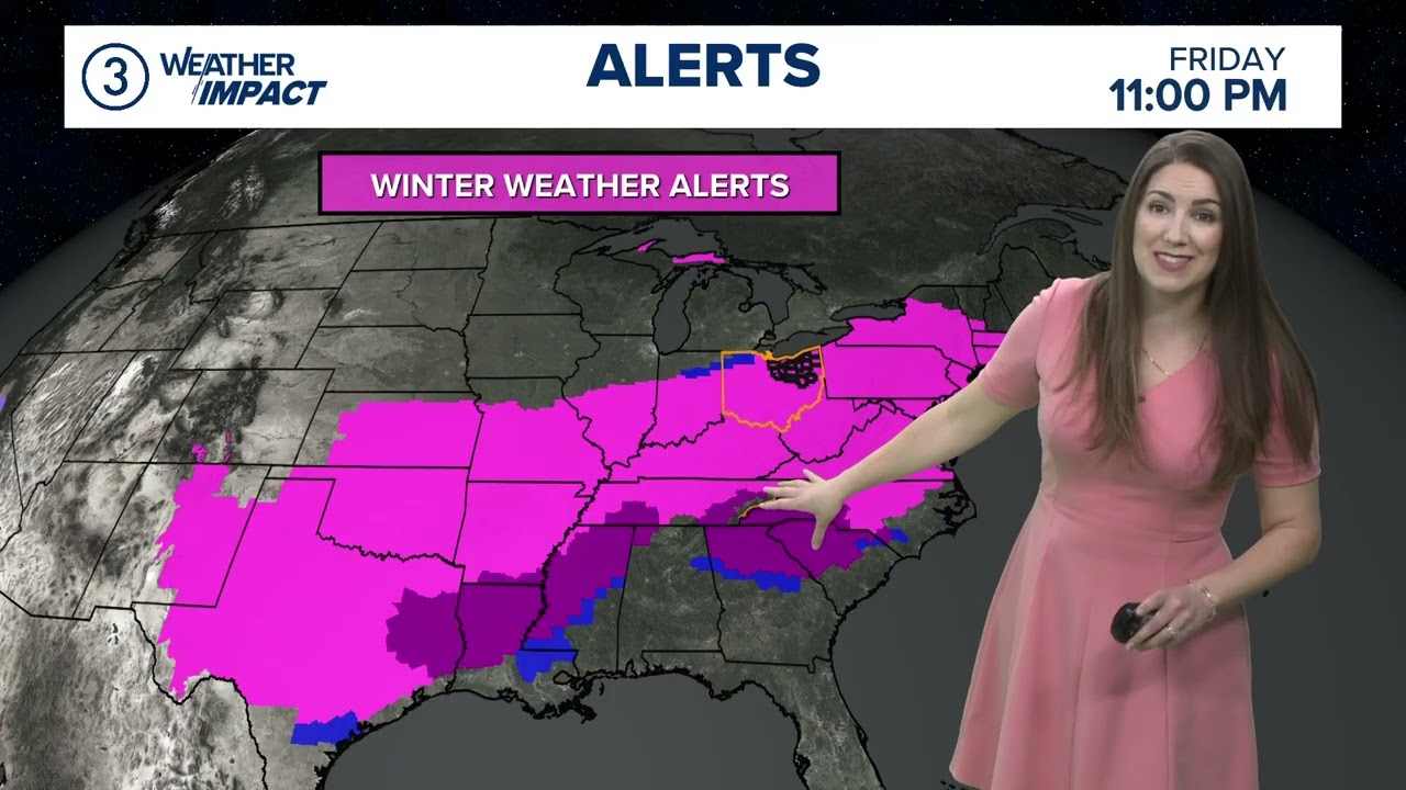
Your 11 p.m. Northeast Ohio Weather Impact forecast for Jan. 23, 2026: Arctic air has settled in and will stick around. Cold Weather Advisories are in place now through Saturday morning. Wind chill values in the minus-10 to minus-20-degree range overnight.
After a bitterly cold start Saturday morning, we'll see temps rebound to near 10 by the afternoon. The wind will be lighter Saturday, so wind-chill values will improve — but it will still be frigid. Sunshine will give way to increasing clouds throughout the day as our winter storm approaches. No snow on Saturday, so use the day to prepare. Make sure those pets are inside and pipes are protected with your cabinets open and a slow drip on the faucets.
Weather Impact Alerts continue Sunday and Monday for accumulating snow. This well-advertised winter storm is developing to our southwest and will impact a 2,000-mile stretch from Texas all the way to the Carolinas into the major cities of the northeastern U.S.
The latest track continues to bring widespread accumulating snow through Ohio late Saturday night through Monday locally. The NWS has placed all of northern Ohio under a Winter Storm Warning beginning Saturday night. Sunday into early Monday will be impacted by a lot of accumulating snow across ALL of northern Ohio. This is not lake effect.
Scattered snow will be arriving Saturday night. Generally 1-2 inches for most by Sunday morning. Snow will become steady and even moderate to heavy as the day goes on. Accumulations will pile up as we get snowfall rates of 1" per hour or more, especially the further south you are.
Scattered snow will be arriving Saturday night. Generally 1-2 inches for most by Sunday morning. Snow will become steady and even moderate to heavy as the day goes on. Accumulations will pile up as we get snowfall rates of 1 inch per hour or more, especially the further south you are.
By Sunday evening, the snow will have accumulated for everyone and the steady snow will begin tapering off. Travel will likely be difficult throughout the day. The worst conditions will likely be Sunday evening before the snow ends and after we lose the daylight. Overall accumulations will range from 8-14 inches with higher amounts possible depending on the track of this storm and what kind of moisture gets thrown in Sunday night into Monday from the lakes. Keep in mind, this is not lake effect — this snow will impact ALL of our viewing area.
Betsy Kling has more of your forecast: https://www.wkyc.com/article/weather/...
At 3News, we’re here to share your voice and tell your story. Share your ideas, thoughts, concerns and engage in conversations about the communities in which we all call home.
Follow 3News on Social:
Facebook: / wkyc.channel3
Twitter: / wkyc
Instagram: / wkyc3
Visit our site: https://www.wkyc.com/
And be sure to download our app here: https://wkyc.com/app
Доступные форматы для скачивания:
Скачать видео mp4
-
Информация по загрузке: