How To Download Digital Elevation Model (DEM) Data from USGS Earth Explorer step by step
Автор: mosaic spatial solutions
Загружено: 2026-01-01
Просмотров: 137
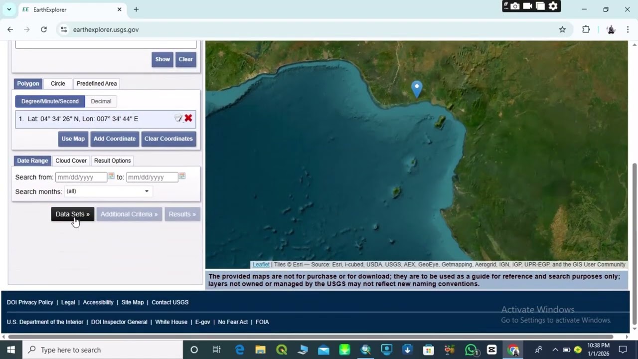
In this tutorial, you’ll learn how to download Digital Elevation Model (DEM) data from USGS Earth Explorer step by step. DEM data is essential for terrain analysis, slope and aspect mapping, hydrology, watershed delineation, flood modeling, and 3D visualization in GIS.
This video walks you through the entire process—from selecting your study area, choosing the right DEM dataset, setting download options, and organizing the data for use in ArcGIS or QGIS. The tutorial is suitable for GIS beginners, students, and professionals who need accurate elevation data for mapping and spatial analysis.
🔍 What you’ll learn:
How to access and use USGS Earth Explorer
Selecting the correct DEM dataset (SRTM, ASTER, etc.)
Downloading DEM data for any location
Preparing DEM files for GIS analysis
👉 Don’t forget to like 👍, comment 💬, and subscribe 🔔 for more GIS and remote sensing tutorials.
CREDIT
MUSIC-Optimist
Artist-Jay Someday
Source-Soundcloud page with free download and
credit usage Details
Доступные форматы для скачивания:
Скачать видео mp4
-
Информация по загрузке:


