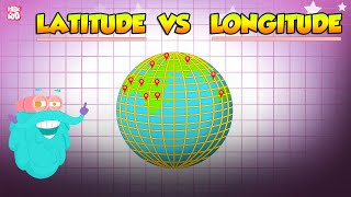
Navigation - Latitude and Longitudes
Автор: Northeast Maritime Institute
Загружено: 2019-09-03
Просмотров: 37056
Captain Dave Medeiros talks about Latitude and Longitude
Looking to become a licensed mariner? Obtain your training and certification with Northeast Maritime Institute. We offer on-site and online training for US and International seafarers. Visit www.northeastmaritime.com for more information.
Explore and subscribe to our YouTube page for more maritime content!
Navigation Plotting is an essential skill for working in the maritime industry. This video is an introduction to some of those concepts. If you've spent lots of time on the water, but have not pursued a professional license, you should consider yourself a candidate for an Operator of Uninspected Passenger Vessels (OUPV) 6-Pack license. This license allows you to charter vessels with up to 6 paying passenger and is the first step to a career in the maritime industry, full-time or part-time!
Copyright © 2019 Northeast Maritime Institute

Доступные форматы для скачивания:
Скачать видео mp4
-
Информация по загрузке: