Teatime Talk - Putting Indigenous People "on the map" in Canada
Автор: British Cartographic Society
Загружено: 2025-05-24
Просмотров: 864
“More indigenous territory has been claimed by maps than by guns. This assertion has its corollary: more indigenous territory can be defended and reclaimed by maps than by guns.”
—Bernard Nietschmann, geographer
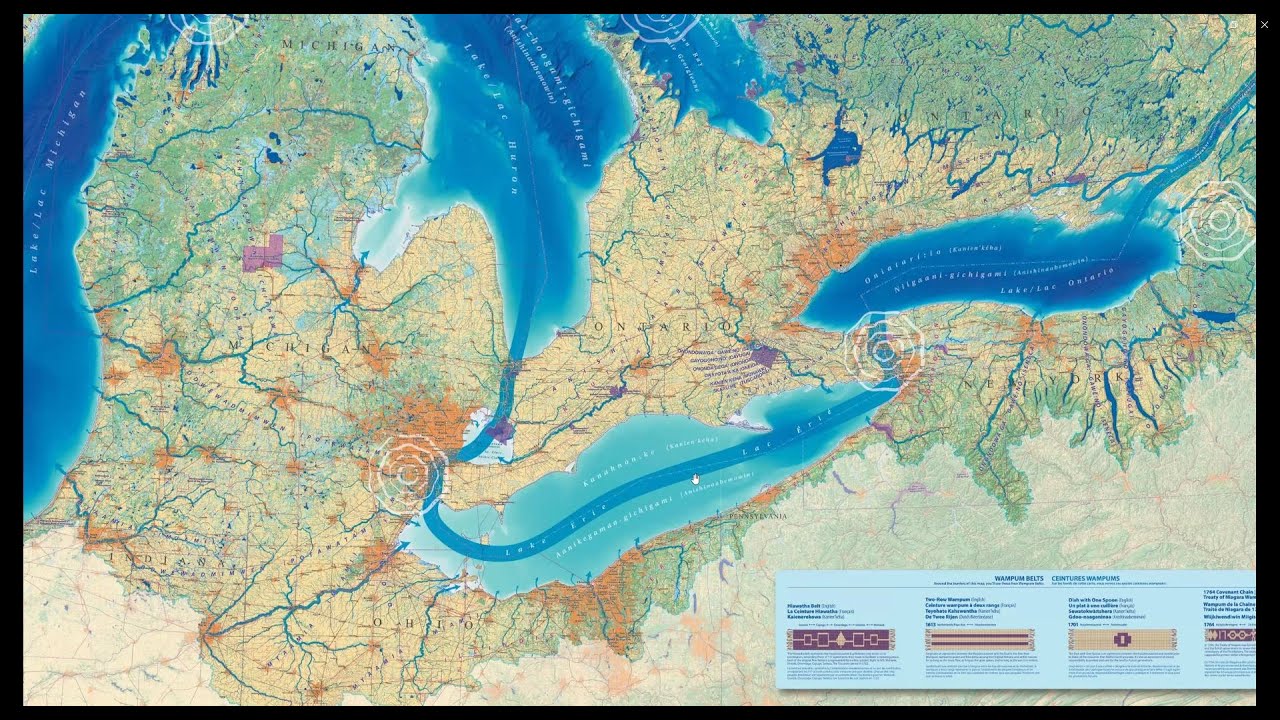
This statement is oft quoted in discussion of both Indigenous land dispossession and of new cartographies that aim to re-place First Peoples onto maps and into collective consciousness. It is a statement that reflects the understanding and ongoing work of Chris Brackley, a Canadian cartographer of European descent who, since working on the Indigenous Peoples Atlas of Canada in 2018, has continuously developed a cartographic approach that seeks to represent the unbroken and foundational connections of local and/or displaced Indigenous People to the land.
In this talk, Chris will share his evolving understanding of the sovereignty of Indigenous and non-Indigenous peoples in Canada, and how this understanding is reflected in the maps he makes for Canadian Geographic Magazine and for other clients.
Chris is a freelance cartographer and part-owner of As the Crow Flies cARTography. He lives in Anishinaabe, Haudenosaunee and Wendake-Nionwentsïo Territory (also known as Ontario), in the Missinnihe (Credit River) Watershed in a small town near a big forest and a meandering river.
Contents
0:00 - Introduction
0:26 - Talk
45:54 - Q&A
Доступные форматы для скачивания:
Скачать видео mp4
-
Информация по загрузке:


