Скачать
Create Topographic Profile/Cross Section/Elevation Profile Using ARCGIS Or 3D Analyst extension
Автор: Technical Esro Arc-GIS Master
Загружено: 2020-04-29
Просмотров: 59143
Описание:
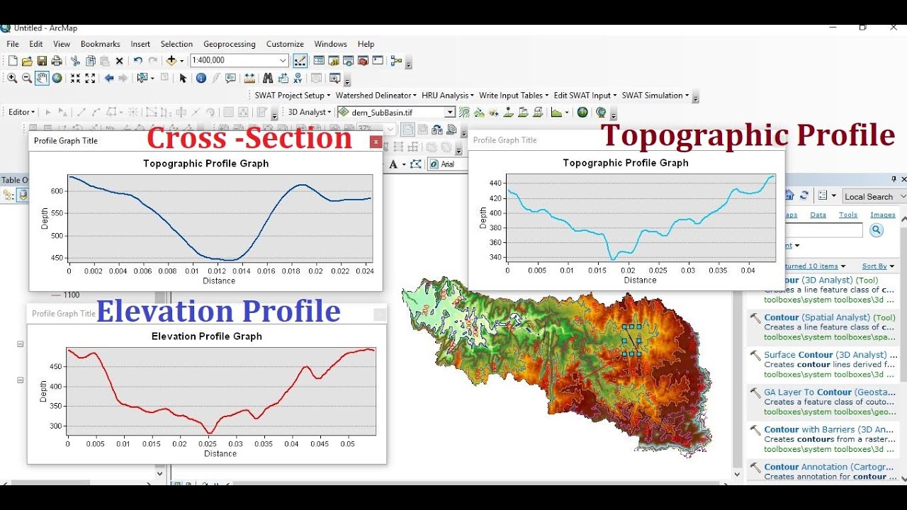
This video tutorial shows you how to extract a topographic profile using the 3D analyst extension. Using ArcGIS you can then make a "blank" cross-section (with a grid and the profile) and export it as a pdf, JPEG, etc.
Using Arc-GIS you can generate Profiles from DEMs.
It is an awesome way to do some preliminary ground-truthing.
Доступные форматы для скачивания:
Скачать видео mp4
-
Информация по загрузке: