Популярное

Музыка Кино и Анимация Автомобили Животные Спорт Путешествия Игры Юмор

Интересные видео

2025 Сериалы Трейлеры Новости Как сделать Видеоуроки Diy своими руками

Топ запросов

смотреть а4 schoolboy runaway турецкий сериал смотреть мультфильмы эдисон
dTub
Скачать

Treeiso: Accurate Individual-Tree Isolation from Terrestrial Laser Scanning (3D Lidar)

Автор: Abderrazzaq Kharroubi

Загружено: 2023-06-21

Просмотров: 17747

Описание:

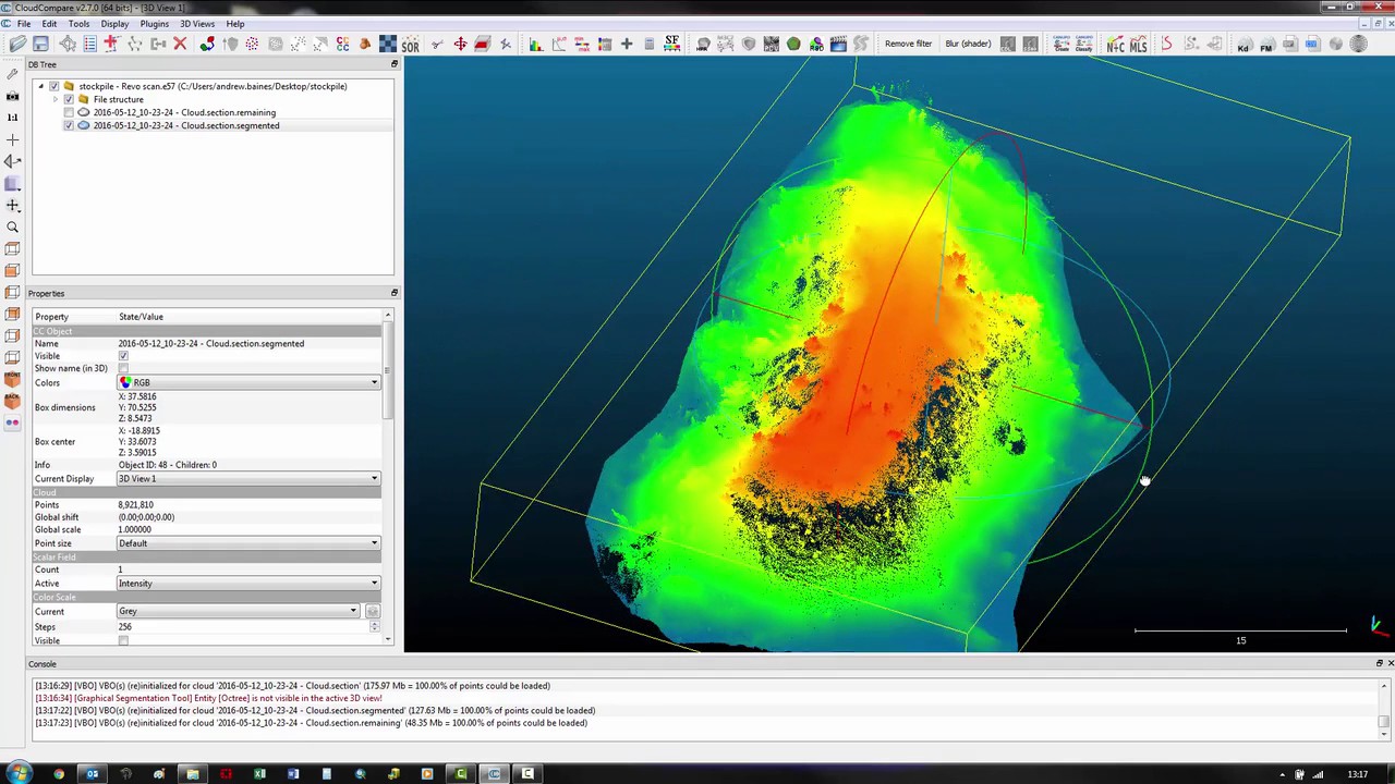
Discover the use of Treeiso, an algorithm that enables precise individual-tree isolation from terrestrial laser scanning data. Learn about the methodology, challenges, and key parameters involved in the process. Join us as we explore the process step-by-step, showcasing the practical implementation using the CloudCompare software. Enhance your understanding of tree analysis and gain valuable insights into the world of individual-tree isolation.

Treeiso: Accurate Individual-Tree Isolation from Terrestrial Laser Scanning (3D Lidar)

Поделиться в:

Доступные форматы для скачивания:

Скачать видео mp4

  • Информация по загрузке:

Скачать аудио mp3

Похожие видео

LiDAR 360 Forestry TLS - лазерная таксация 250 деревьев. Наземное лазерное сканирование.

LiDAR 360 Forestry TLS - лазерная таксация 250 деревьев. Наземное лазерное сканирование.

Terrestrial Laser Scanning - How Control Influences Point Cloud Accuracy

Terrestrial Laser Scanning - How Control Influences Point Cloud Accuracy

We Just Hit the Physics Wall (It's Over)

We Just Hit the Physics Wall (It's Over)

Terrestrial Laser Scanning 101 : What, Why & How?

Terrestrial Laser Scanning 101 : What, Why & How?

Как захватывать и обрабатывать данные SLAM-лидара на лидаре Resepi XT32.

Как захватывать и обрабатывать данные SLAM-лидара на лидаре Resepi XT32.

КАК ИЗВЛЕЧЬ ДЕРЕВЬЯ ИЗ ДАННЫХ ЛИДАР В ARCGIS PRO

КАК ИЗВЛЕЧЬ ДЕРЕВЬЯ ИЗ ДАННЫХ ЛИДАР В ARCGIS PRO

Canopy Height Model CHM from Air LiDAR with Cloudcompare

Canopy Height Model CHM from Air LiDAR with Cloudcompare

Наземное лазерное сканирование (НЛС) лесов

Наземное лазерное сканирование (НЛС) лесов

3D Point Cloud Course for Beginners in 99-minute  (CloudCompare, Python, Potree, Segmentation)

3D Point Cloud Course for Beginners in 99-minute (CloudCompare, Python, Potree, Segmentation)

GreenValley Webinar: Extracting Individual Tree Metrics from LiDAR Data

GreenValley Webinar: Extracting Individual Tree Metrics from LiDAR Data

RealityCapture: Making a 3D model from photos and laser scans

RealityCapture: Making a 3D model from photos and laser scans

How to create DEM, DSM and normalized DSM? Cloudcompare

How to create DEM, DSM and normalized DSM? Cloudcompare

LiDAR 3D Gaussian Splats and AI with Sunny from XGRIDS Full Webinar

LiDAR 3D Gaussian Splats and AI with Sunny from XGRIDS Full Webinar

Canopy Height Model With Cloud Compare

Canopy Height Model With Cloud Compare

CloudCompare2.5D - LIDARUAV - Calculate the volume of a stockpile Point Cloud

CloudCompare2.5D - LIDARUAV - Calculate the volume of a stockpile Point Cloud

Cloud Compare 2: Point segmentation

Cloud Compare 2: Point segmentation

Cloud Compare 4: Generate DEMs and Contours

Cloud Compare 4: Generate DEMs and Contours

Master LiDAR Data Processing (Full Walkthrough!)

Master LiDAR Data Processing (Full Walkthrough!)

Manual/Automatic classification and segmentation

Manual/Automatic classification and segmentation

LiDAR topography To Rhino

LiDAR topography To Rhino

© 2025 dtub. Все права защищены.


  • Контакты
  • О нас
  • Политика конфиденциальности


Контакты для правообладателей: infodtube@gmail.com