Digitizing Made EASY in QGIS | Roads, Polygons & Landmarks (Step-by-Step)
Автор: Forester J Maps
Загружено: 2026-01-15
Просмотров: 7
Want to learn DIGITIZING USING QGIS step by step?
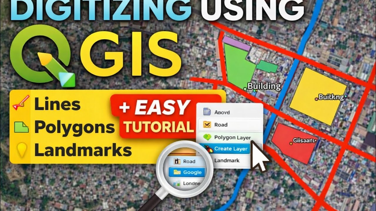
In this tutorial, I’ll show you how to digitize roads, polygons, and landmarks using Google Satellite in QGIS — perfect for beginners, GIS students, and thesis users.
📌 What you’ll learn in this video:
✔ How to add Google Satellite basemap
✔ Digitizing roads and rivers (LineString)
✔ Digitizing areas (Polygon)
✔ Adding landmarks (Point)
✔ Viewing attribute tables
✔ Calculating area in hectares
✔ Labeling and styling layers
This tutorial uses real satellite imagery and a clear, step-by-step workflow to help you understand digitizing easily.
👉 If this video helps you:
👍 Like the video
💬 Comment your questions
🔔 Subscribe for more QGIS & GIS tutorials
📤 Share this with your classmates and thesis mates
#QGIS
#DigitizingUsingQGIS
#QGISTutorial
#GIS
#GISBeginners
#GISStudents
#Geospatial
#Mapping
#Cartography
#OpenSourceGIS
#SpatialAnalysis
#RemoteSensing
#GISPhilippines
#ThesisGIS
#LearnQGIS
#QGISDigitizing
#GISWorkflow
Доступные форматы для скачивания:
Скачать видео mp4
-
Информация по загрузке:


