Flood_4:Urban Flood Likelihood Mapping Using Google Earth Engine
Автор: datapartnership
Загружено: 2026-01-03
Просмотров: 42
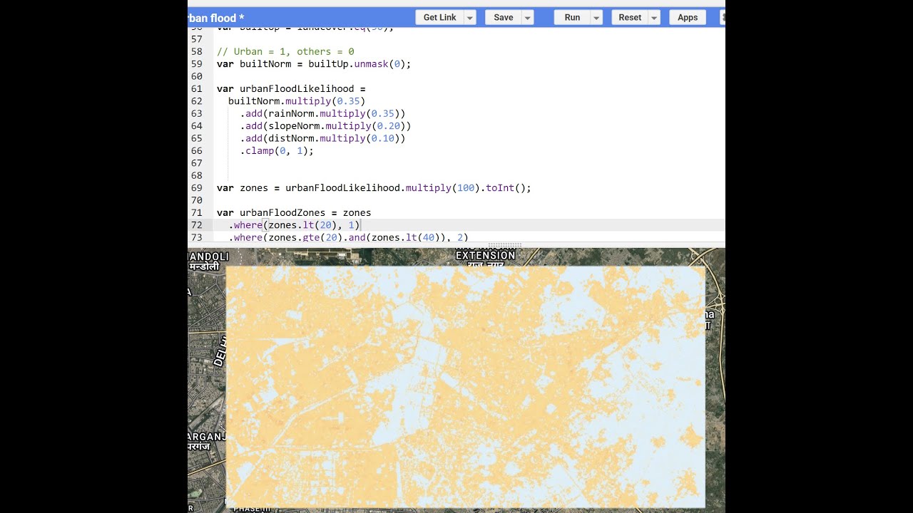
In this video, I demonstrate how to create an urban flood likelihood map using Google Earth Engine and open satellite datasets.
The analysis focuses on rainfall-driven urban flooding, which commonly occurs due to high impervious surfaces, low slopes, and limited drainage capacity—often away from rivers.
By combining terrain slope (SRTM DEM), rainfall data (GPM IMERG), distance to rivers, and built-up land cover, a flood likelihood index is generated and classified into five flood risk zones ranging from very low to very high risk.
This approach produces a relative flood susceptibility map, useful for urban planning, risk screening, and identifying flood-prone hotspots, rather than predicting actual flood depth or inundation extent.
The workflow is fully reproducible and can be applied to any urban area worldwide using freely available satellite data.
Please also refer:
• Flood_3: Flood Likelihood using Google Ear...
• Flood_4: Flood Likelihood Zones Mapping Us...
• Flood_3: Rainfall-Based Flood Likelihood M...
#urban Flooding #flood #floods ,#floodrelief #disastermanagement #satellite #education #gis #resilience
Доступные форматы для скачивания:
Скачать видео mp4
-
Информация по загрузке:


