Скачать
Nanaimo Map in 3D! (CITY of NANAIMO)
Автор: City Of Nanaimo
Загружено: 3 апр. 2025 г.
Просмотров: 282 просмотра
Описание:
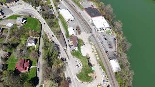
This 3D model of Nanaimo is made possible by advances in technology and the precision of modern GPS. Since 2021, the City has been routinely collecting aerial survey photography of Nanaimo every two years. Using these same images, we’ve created a 3D rendering of Nanaimo.
The City is making the model data available to interested parties through our Open Data License. This will allow developers to download and modify the content to insert a new Building Information Model (BIM), allowing for a true-to-scale look at how a building will fit in with it's neighbourhood.

Доступные форматы для скачивания:
Скачать видео mp4
-
Информация по загрузке: