How Do You Highlight a Country on a World Map Using Python and Plotly?
Автор: PyPlus
Загружено: 2026-01-15
Просмотров: 0
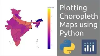
In this video, you’ll learn how to highlight any country on a world map using Python and Plotly.
By taking the country name as user input, we generate an interactive choropleth world map that visually highlights the selected country. This technique is useful for geographic data visualization, dashboards, and data science projects.
What you’ll learn:
How to use Plotly Express for map visualization
How to create a choropleth world map in Python
How to highlight a specific country dynamically
How to work with user input in Python
Basics of geographic data visualization
This tutorial is ideal for:
Python beginners
Data visualization learners
GIS & map visualization enthusiasts
Interactive dashboard creators
📌 Library used: Plotly Express
🗺️ Visualization type: Choropleth Map
💻 Language: Python
If you enjoyed this video, like, share, and subscribe for more Python visualization tutorials
#Python
#Plotly
#WorldMap
#DataVisualization
#ChoroplethMap
#PythonTutorial
#GeographicData
#GIS
#LearnPython
#Programming

Доступные форматы для скачивания:
Скачать видео mp4
-
Информация по загрузке: