Популярное

Музыка Кино и Анимация Автомобили Животные Спорт Путешествия Игры Юмор

Интересные видео

2025 Сериалы Трейлеры Новости Как сделать Видеоуроки Diy своими руками

Топ запросов

смотреть а4 schoolboy runaway турецкий сериал смотреть мультфильмы эдисон
dTub
Скачать

How to calculate surfaces & volumes with Zenith60 and X PAD

Автор: Hitechniques Ltd.

Загружено: 2022-09-16

Просмотров: 4761

Описание:

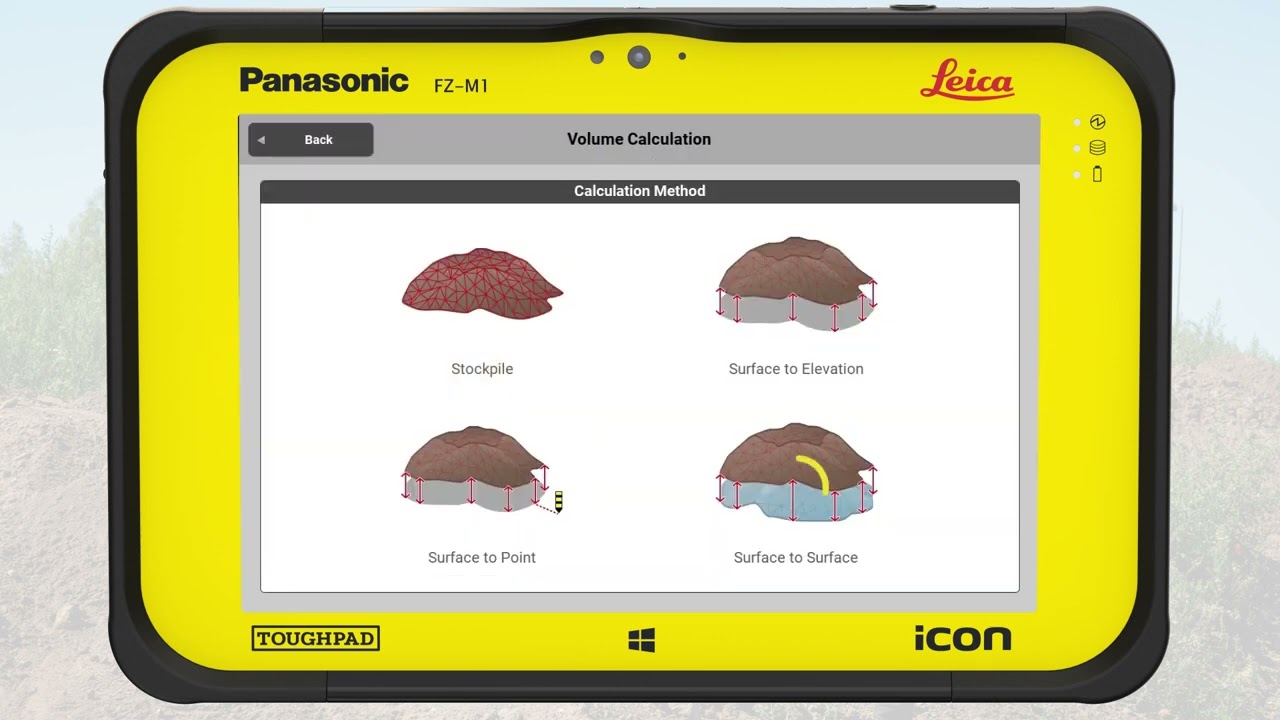
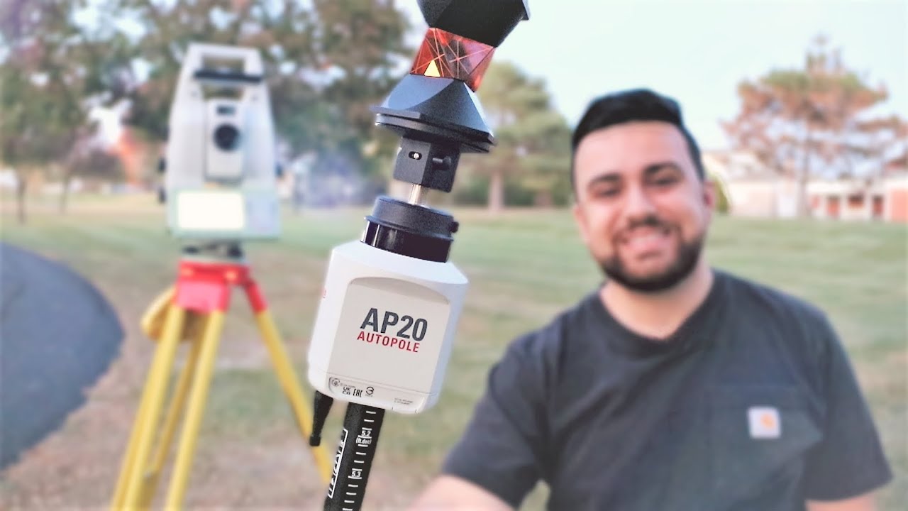
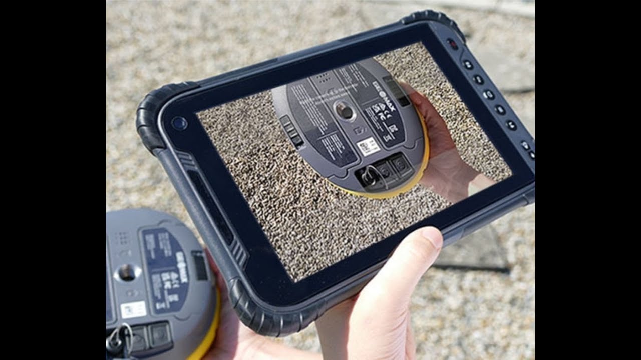
Creating stockpile surface and volume report with #GeoMax Zenith60 GNSS receiver and X-PAD software.

Get in touch with us to learn more about GeoMax surveying solutions. Email info@hitechniques.ie today

#switchtogeomax #workswhenyoudo #surveying #surveyors

How to calculate surfaces & volumes with Zenith60 and X PAD

Поделиться в:

Доступные форматы для скачивания:

Скачать видео mp4

  • Информация по загрузке:

Скачать аудио mp3

Похожие видео

GeoMax Zenith 60 & Sonar Single Beam Surveying

GeoMax Zenith 60 & Sonar Single Beam Surveying

How to create surfaces and calculate volume in Leica iCON site

How to create surfaces and calculate volume in Leica iCON site

APEKS GNSS | AP20 & AP40Laser unboxing video

APEKS GNSS | AP20 & AP40Laser unboxing video

Потери России и Украины в период СВО. Разбор и анализ.

Потери России и Украины в период СВО. Разбор и анализ.

RTK GPS/GNSS с базой и ровером

RTK GPS/GNSS с базой и ровером

ROTATIVO SPECTRA DIGITALE GL 412 - 422

ROTATIVO SPECTRA DIGITALE GL 412 - 422

VLOG, E4/S1 - Разметка осей зданий (GeoMax Zoom 95, Zenith 60, X-Pole, X-PAD)

VLOG, E4/S1 - Разметка осей зданий (GeoMax Zoom 95, Zenith 60, X-Pole, X-PAD)

Tyczenie osi z mapy tachimetrem Geomax Zoom95

Tyczenie osi z mapy tachimetrem Geomax Zoom95

Насколько точен Leica AP20 AutoPole при использовании с тахеометром?

Насколько точен Leica AP20 AutoPole при использовании с тахеометром?

Vi tester   Geomax Zenith 60 VS Geomax Zenith 40 antenna

Vi tester Geomax Zenith 60 VS Geomax Zenith 40 antenna

Как правильно сматывать верёвку

Как правильно сматывать верёвку

GeoMax - X-PAD Ultimate - COORDINATE SYSTEM - GNSS site calibration

GeoMax - X-PAD Ultimate - COORDINATE SYSTEM - GNSS site calibration

System Design Concepts Course and Interview Prep

System Design Concepts Course and Interview Prep

Как геодезист определяет границы вашего участка

Как геодезист определяет границы вашего участка

Geomax X-Pad Automeasuring tutorial

Geomax X-Pad Automeasuring tutorial

GEOMAX Zenith06 - La recensione (REVIEW) di Topografi.it

GEOMAX Zenith06 - La recensione (REVIEW) di Topografi.it

The GeoMax Zenith 60 Demo

The GeoMax Zenith 60 Demo

How to connect GEOMAX RTK Base and Rover Zenith60 | X-PAD Survey

How to connect GEOMAX RTK Base and Rover Zenith60 | X-PAD Survey

Full Design of Homogeneous Dam type by using Civil 3D including Excavation Volume.

Full Design of Homogeneous Dam type by using Civil 3D including Excavation Volume.

WEBINAR & LIVE DEMO   How to overcome 5 common GNSS surveying struggles with the Zenith60

WEBINAR & LIVE DEMO How to overcome 5 common GNSS surveying struggles with the Zenith60

© 2025 dtub. Все права защищены.


  • Контакты
  • О нас
  • Политика конфиденциальности


Контакты для правообладателей: infodtube@gmail.com