Скачать
(RTR 4.16.7) Displaying Geologic Cross Sections & Geophysical Profiles
Автор: RockWareSoftware
Загружено: 2011-12-19
Просмотров: 8578
Описание:
http://www.rockware.com (RockWare Website)
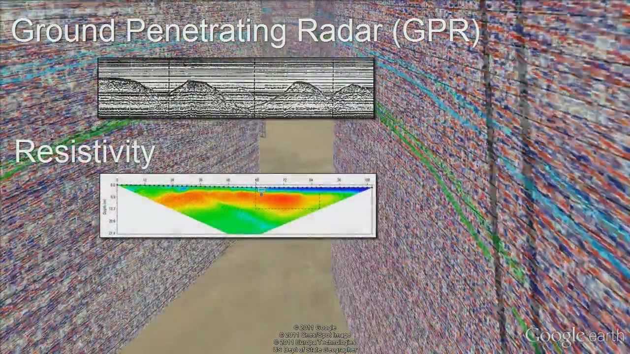
This video shows how the forthcoming EarthApps product may be used to display vertical images representing geologic cross-sections and geophysical profiles within Google Earth. EarthApps is a collection of free utilities that are used to convert data into diagrams that are displayed within Google Earth. Other videos on the RockWorks YouTube channel show additional EarthApps capabilities (e.g. extruded state maps, tube maps, strike-and-dip disks, etc.). There are currently 77 programs within EarthApps (and we're not done yet!).
Доступные форматы для скачивания:
Скачать видео mp4
-
Информация по загрузке: