Популярное

Музыка Кино и Анимация Автомобили Животные Спорт Путешествия Игры Юмор

Интересные видео

2025 Сериалы Трейлеры Новости Как сделать Видеоуроки Diy своими руками

Топ запросов

смотреть а4 schoolboy runaway турецкий сериал смотреть мультфильмы эдисон
dTub
Скачать

Using R for Geographic Information System (GIS) and Landscape Analyses

Автор: CalgaryR R User Group

Загружено: 2021-10-28

Просмотров: 1884

Описание:

Presentation by Danielle Clake

Hosted by CalgaryR: https://imstatsbee.github.io/calgaryr...

The loss of habitat is a well-known challenge facing global biodiversity, but we still require a better understanding of how specific aspects of landscape changes can affect communities. For example, while the amount of habitat available to a species is known to be important for its survival, there can also be an influence of the configuration of that habitat into one or many patches, or of the patches into either simple or complex shapes. Different landscape metrics have been developed to characterize these and other differences between habitats. R provides useful tools to calculate and assess landscape metrics, and to integrate the results into downstream analysis and modelling.

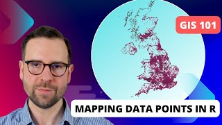
In this talk I will provide a brief overview of the basics of spatial data and geographic information system (GIS) analysis in R, using the sf and raster packages to create and visualize spatial data. I will then show how the landscapemetrics package can be used to characterize the composition and configuration of landscapes.

My research on bumble bee (Bombus sp.) habitat in the Rocky Mountains is an example of how these types of landscape analyses can be applied to test hypotheses about the relationships between species and the landscapes that they inhabit. I will discuss my findings in this project, and the various uses of R throughout.

Using R for Geographic Information System (GIS) and Landscape Analyses

Поделиться в:

Доступные форматы для скачивания:

Скачать видео mp4

  • Информация по загрузке:

Скачать аудио mp3

Похожие видео

Jared Lander - Using R for GIS and Mapping

Jared Lander - Using R for GIS and Mapping

MAREK BUDZISZ - Współczesna wojna, deregulacja, systemy podwójnego przeznaczenia - BIZNES TRENDY2025

MAREK BUDZISZ - Współczesna wojna, deregulacja, systemy podwójnego przeznaczenia - BIZNES TRENDY2025

Основы ПЛК: структурированный текст

Основы ПЛК: структурированный текст

4 Hours Chopin for Studying, Concentration & Relaxation

4 Hours Chopin for Studying, Concentration & Relaxation

Проектирование системы WHATSAPP: системы чат-сообщений для собеседований

Проектирование системы WHATSAPP: системы чат-сообщений для собеседований

Бактериальная генетика

Бактериальная генетика

Remote Sensing Analysis with R: Land use and Land Cover Classification using Machine learning in R

Remote Sensing Analysis with R: Land use and Land Cover Classification using Machine learning in R

Analyzing Geospatial Data in R (Sherrie Xie)

Analyzing Geospatial Data in R (Sherrie Xie)

Soil Health in High Tunnels on Diversified Vegetable Farms: Lessons Learned From the 100 Farms Study

Soil Health in High Tunnels on Diversified Vegetable Farms: Lessons Learned From the 100 Farms Study

Музыка для работы за компьютером | Фоновая музыка для концентрации и продуктивности

Музыка для работы за компьютером | Фоновая музыка для концентрации и продуктивности

Война завершается / НАТО вступает в бой / Атака на остров

Война завершается / НАТО вступает в бой / Атака на остров

Tutorial on 80% of everything you will EVER need to know in R (for ecology) [IN ONE HOUR]!

Tutorial on 80% of everything you will EVER need to know in R (for ecology) [IN ONE HOUR]!

Harnessing the Power of R in ArcGIS with R-ArcGIS Bridge

Harnessing the Power of R in ArcGIS with R-ArcGIS Bridge

Validation of the underlying construct of survey instruments

Validation of the underlying construct of survey instruments

Физически-информированные нейронные сети (PINN) [Машинное обучение с учетом физики]

Физически-информированные нейронные сети (PINN) [Машинное обучение с учетом физики]

ГИС 101: Картографирование точек данных в R

ГИС 101: Картографирование точек данных в R

Dinis Abranches - From noise to knowledge: stochastic machine learning for materials design

Dinis Abranches - From noise to knowledge: stochastic machine learning for materials design

How to Replace Lawn & Turf in the Pacific Northwest

How to Replace Lawn & Turf in the Pacific Northwest

Landsat NDVI time-series in Google Earth Engine

Landsat NDVI time-series in Google Earth Engine

Advanced GIS Methods Training: Short Course on Using R as a GIS: Part 1

Advanced GIS Methods Training: Short Course on Using R as a GIS: Part 1

© 2025 dtub. Все права защищены.


  • Контакты
  • О нас
  • Политика конфиденциальности


Контакты для правообладателей: [email protected]