PostGIS : Gérer des données géographiques dans PostgreSQL
Автор: Smals Research
Загружено: 2022-10-03
Просмотров: 1877
Webinar Smals Research - "PostGIS : Gérer des données géographiques dans PostgreSQL", september 27, 2022
Slides available on https://www.smalsresearch.be/download...
Toutes les institutions possèdent, parfois sans réellement le savoir, des informations géographiques : adresses de citoyens, institutions, localisation d’un chantier, nom de villes/communes ou code postal… Par ailleurs, une mine d’information est disponible en ligne, souvent en open source, permettant d’obtenir les contours d’entités administratives, d’obtenir la localisation de commerces ou administrations.
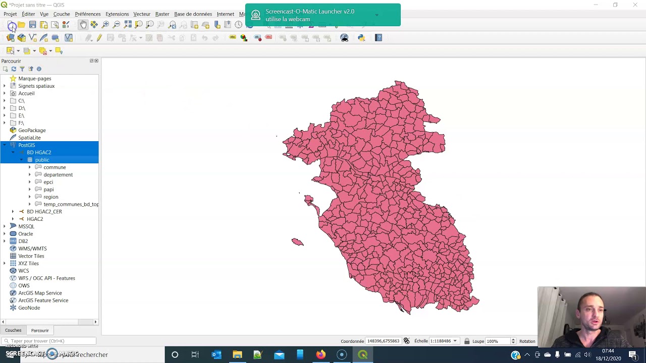
Il est dès lors souvent utile de pouvoir manipuler des objets géographiques : un point (localisation d'un chantier, d'une observation, d'un incident...), une ligne (un itinéraire, une route...) ou un polygone (frontière d'une commune, contour d'un chantier ou d'un bâtiment). En dehors de simples points (couples de coordonnées), les bases de données classiques comme PostgreSQL ou Oracle ne permettent pas de représenter et de manipuler ces objets efficacement.
Dans ce webinaire, nous examinerons comment PostGIS, une extension de PostgreSQL, permet de gérer des objets spatiaux (ou géographiques) et d’étendre largement les possibilités d’analyse, de croisement, d’enrichissement ou de représentation des données.
Nous y verrons les concepts de jointure spatiale (jointure de tables sur base d’informations géographiques), d'agrégation, d’indexation ou encore de chargement de données. Ces concepts, très puissants, sont fondamentaux pour la manipulation de données géographiques.
Visitez-nous sur https://www.smalsresearch.be
__________________________________________________________________________________________
Webinar Smals Research - "PostGIS: geografische gegevens beheren in PostgreSQL", september 27, 2022
Slides available on https://www.smalsresearch.be/download...
Alle instellingen beschikken, soms zonder het echt te weten, over geografische informatie: adressen van burgers, instellingen, locatie van een werf, namen van steden/gemeenten of postcodes... Bovendien is een schat aan informatie online beschikbaar, vaak in open broncode, waardoor het mogelijk is de contouren van administratieve entiteiten te verkrijgen, de locatie van winkels of administraties te achterhalen.
Het is dus vaak nuttig om geografische objecten te kunnen manipuleren: een punt (locatie van een werf, een waarneming, een incident, enz.), een lijn (een route, een weg, enz.) of een veelhoek (grens van een gemeente, omtrek van een werf of een gebouw). Afgezien van eenvoudige punten (paren van coördinaten), laten klassieke databanken zoals PostgreSQL of Oracle niet toe deze objecten efficiënt weer te geven en te manipuleren.
In dit webinar zullen we onderzoeken hoe PostGIS, een uitbreiding van PostgreSQL, kan omgaan met deze ruimtelijke (of geografische) objecten en de mogelijkheden voor gegevensanalyse, kruisverwijzingen, verrijking of weergave sterk kan uitbreiden.
Daarbij zullen concepten zoals “spatial join” (samenvoeging van tabellen op basis van geografische informatie), aggregatie, indexering en het laden van gegevens besproken worden. Deze concepten zijn zeer krachtig en fundamenteel voor de manipulatie van geografische gegevens.
Bezoek ons op https://www.smalsresearch.be

Доступные форматы для скачивания:
Скачать видео mp4
-
Информация по загрузке: