Marine Beach Drone Survey applications example of workflow
Автор: Victoria Air Photos and Survey
Загружено: 2025-12-02
Просмотров: 93
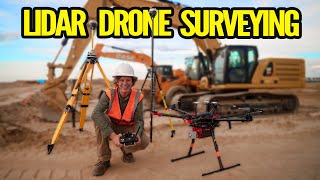
In this video, we take you via small vessel to a private island in the Salish sea where we deploy to drone map the areas of interest. Footage is shared of the project along with the completed processed maps.
Why go through the risk and stress and high cost of doing it yourself? Mobilize us for your next project. At VAP, we have 14 years of professional experience flying drones in and out of season!
Examples of application include beach/cliff erosion monitoring, maritime plastic pollution counting, wildlife tracking, and sea vegetation assessment.
VAP only uses the best drone sensors for data acquisition and quality resolution for accuracy.
#beach #survey #dronefootage
Visit https://victoriaairphotos.com/marine-...

Доступные форматы для скачивания:
Скачать видео mp4
-
Информация по загрузке:


![☀ Новая экшн 6. Квадратный дюйм или гениальный маркетинг? [DJI Action 6]](https://ricktube.ru/thumbnail/zWqCNyzN9-Q/mqdefault.jpg)


