Популярное

Музыка Кино и Анимация Автомобили Животные Спорт Путешествия Игры Юмор

Интересные видео

2025 Сериалы Трейлеры Новости Как сделать Видеоуроки Diy своими руками

Топ запросов

смотреть а4 schoolboy runaway турецкий сериал смотреть мультфильмы эдисон
dTub
Скачать

Use QGIS to Delineate Catchments of Streams Flowing into a Lake

Автор: Hans van der Kwast

Загружено: 2023-12-30

Просмотров: 3783

Описание:

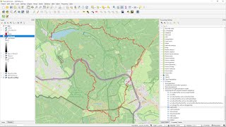
In this video, you'll learn how to delineate catchments of streams that drain into a lake. First, we'll download the lake from OpenStreetMap. Next, we'll create a mask polygon that we'll use to mask elevation values in the lake. Finally, we'll use the Pit and Catchment tools of the PCRaster Tools plugin to delineate the catchments.

QGIS version: 3.28
Plugins: QuickOSM, PCRaster Tools
Open Data: SRTM, (c) OpenStreetMap Contributors

Thanks to Melina for discussing this case study with me, which was the inspiration for this video.

0:00 Introduction
0:39 Download lakes with QuickOSM
2:33 Create a polygon from the DEM extent
3:06 Use the Difference tool to clip the lake from the extent polygon
3:50 Use the difference layer to mask the lake from the DEM
4:39 Convert to PCRaster format and calculate flow direction
5:33 Use the Pit tool to create the layer with outlets
6:05 Use the Catchment tool to delineate the catchments of the outlets

#QGIS #PCRaster #QGISHydro

Use QGIS to Delineate Catchments of Streams Flowing into a Lake

Поделиться в:

Доступные форматы для скачивания:

Скачать видео mp4

  • Информация по загрузке:

Скачать аудио mp3

Похожие видео

Stream and Catchment Delineation in QGIS using SAGA Tools

Stream and Catchment Delineation in QGIS using SAGA Tools

Получение речной сети и водосборов из ЦМР с помощью QGIS

Получение речной сети и водосборов из ЦМР с помощью QGIS

Create a Catchment Map in QGIS in 10 Minutes

Create a Catchment Map in QGIS in 10 Minutes

Tools for Stream and Catchment Delineation with QGIS

Tools for Stream and Catchment Delineation with QGIS

Разблокировка нейросетей (AI) без VPN

Разблокировка нейросетей (AI) без VPN

Как двойные роторы делают двигатели невероятно эффективными

Как двойные роторы делают двигатели невероятно эффективными

33 продукта из отходов, которые вы едите каждый день

33 продукта из отходов, которые вы едите каждый день

QGIS for Hydrology - Catchment Delineation

QGIS for Hydrology - Catchment Delineation

Во всем виноват любимый Зеленского?

Во всем виноват любимый Зеленского?

Derive Urban Footprint with QGIS

Derive Urban Footprint with QGIS

Падение

Падение "легенды": Фейковая ракета на вооружении армии России

Как я выдавливал дерево, чтобы сделать этот стол

Как я выдавливал дерево, чтобы сделать этот стол

Calculate the Catchment of a Reservoir Lake in QGIS

Calculate the Catchment of a Reservoir Lake in QGIS

Выучите R за 39 минут

Выучите R за 39 минут

Digital Sovereignty and Open Source Software for Geo

Digital Sovereignty and Open Source Software for Geo

QGIS 3.44 Visual Changelog

QGIS 3.44 Visual Changelog

Россия начала захват КНДР / Путин заявил о продвижении войск

Россия начала захват КНДР / Путин заявил о продвижении войск

Watershed Delineation in QGIS (Quickest & Easiest Tutorial)

Watershed Delineation in QGIS (Quickest & Easiest Tutorial)

Расчет объема с помощью QGIS

Расчет объема с помощью QGIS

ESP32: распознавание речи нейросетью (TensorFlow Lite)

ESP32: распознавание речи нейросетью (TensorFlow Lite)

© 2025 dtub. Все права защищены.


  • Контакты
  • О нас
  • Политика конфиденциальности


Контакты для правообладателей: [email protected]