Maglič - Stolovi
Автор: Marko Randjic
Загружено: 2020-10-25
Просмотров: 2359
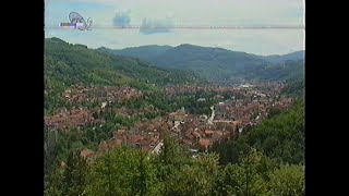
18. 10. 2020. Sedam planinara PK "Era" Užice izvršilo je uspon na najviši vrh planine Stolova, vrh Kamarište (1375m), stazom od srednjovekovne tvrđave Maglič. Tura je otpočela prelaskom reke Ibra čamcem, i kraćom posetom gradu Magliču. Odatle se nastavilo uz Gradsku kosu do vrha Kozarevo brdo (838m), a zatim dalje grebenom. Staza je išla obroncima vrha Lipar (894m), mesta zvanog Prevoja, obroncima vrha Velika čuka (1027m), mesta zvanog Mala čuka (1045m), obroncima vrha Čiker (1325m), do glavnog odredišta, Kamarišta (1375m). Strma staza je dalje vodila preko vrhova Greda (1026m), i Klečak (866m), do doline reke Maglašnice. Usled nemogućnosti ponovnog prelaska reke čamcem, tura je nastavljena duž stare pruge, preko nekadašnje železničke stanice Dobre Strane, i starog mosta na Ibru, i dalje ka polaznoj tački. Dužina ture iznosila je 19,5km, uz visinsku razliku od 1362m u usponu, i 1346m u silasku.
Seven mountaineers of PK "Era" Užice performed an ascent to the summit of Mt. Stolovi, Kamarište (1375m), following the trail from the medieval fortress of Maglič. The tour started by crossing the river Ibar by a boat, and a short visit to Maglič. From there the tour continued up Gradska Kosa slope, to Kozarevo Brdo peak (838m), and further along the ridge. The trail went along the slopes of Lipar Peak (894m), the place called Prevoja, the slopes of Velika Čuka (1027m) peak, the place called Mala Čuka (1045m), the slopes of Čiker Peak (1325m), to the main objective, Kamarište Peak (1375m). The steep trail went on via Greda (1026m), and Klečak (866m) peaks to the Maglašnica River valley. Due to the inability to cross the river by a boat again, the tour continued along the old railway, via the old railway station Dobre Strane, and the old bridge across the Ibar River, and further on, towards the starting point. Tour length: 19,5km. Elevation gain uphill: 1362m, and downhill: 1346m.
GPS trek sa ove ture možete da preuzmete ovde: / You can download the GPS track from this tour here: https://www.wikiloc.com/mountaineerin...
Lord of the Land Kevin MacLeod (incompetech.com)
Licensed under Creative Commons: By Attribution 3.0 License
http://creativecommons.org/licenses/b...
Crunk Knight Kevin MacLeod (incompetech.com)
Licensed under Creative Commons: By Attribution 3.0 License
http://creativecommons.org/licenses/b...

Доступные форматы для скачивания:
Скачать видео mp4
-
Информация по загрузке:
![[4K] Ivanjica - Serbia🇷🇸Town Centre](https://ricktube.ru/thumbnail/i1-q7wneHbM/mqdefault.jpg)