Preprocessing Real Sentinel-2 Imagery for Deep Learning: Geospatial AI Tutorial
Автор: Dr. Azad Rasul
Загружено: 2025-09-14
Просмотров: 196
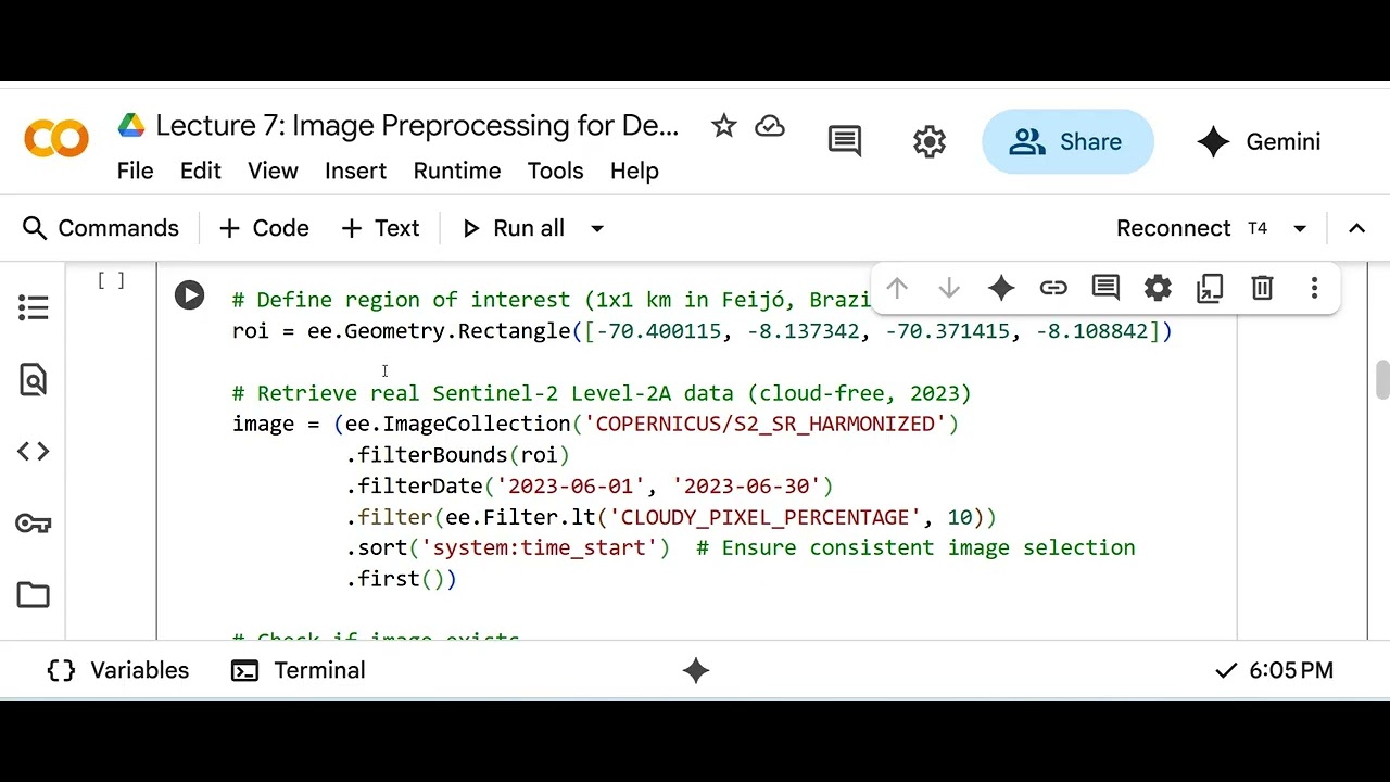
In Lecture 7 of Advanced Geospatial AI, learn how to preprocess real Sentinel-2 Level-2A satellite imagery for deep learning with Python and Google Earth Engine! We retrieve a cloud-free image from a 1x1 km region in Brazil, extract a 32x32 patch (RGB + NIR), and apply resizing, normalization, and augmentation for a CNN like ResNet-18. With robust GEE authentication and reproducible augmentations, this tutorial is perfect for geospatial enthusiasts and data scientists! What You’ll Learn:Setting up Google Earth Engine authentication in Colab
Retrieving and validating Sentinel-2 Level-2A data
Extracting and preprocessing a 32x32 image patch
Resizing, normalizing, and augmenting with albumentations
Ensuring reproducibility with seed control and data validation
Google Earth Engine: https://earthengine.google.com/
PyTorch: https://pytorch.org/
Dataset: Sentinel-2 Level-2A (via GEE, project ID: my-project-test-399218)
Subscribe for more geospatial AI and remote sensing tutorials! Drop a comment with questions or ideas. Let’s master satellite imagery analysis!
#GeospatialAI #RemoteSensing #Sentinel2 #DeepLearning #ImagePreprocessing #GoogleEarthEngine #DataScience
Доступные форматы для скачивания:
Скачать видео mp4
-
Информация по загрузке:


![Как происходит модернизация остаточных соединений [mHC]](https://image.4k-video.ru/id-video/jYn_1PpRzxI)